. . . Three Approaches to Solving Water Issues
![]()
![]()
Lake Powell Pipeline(see pages 1, 12, & 14)Image below is Lake Powell Pipeline pathway to St. George (the rejected pathway to lift water to Cedar Valley not shown) The rejected proposal was to pay $20,000 per acre-foot for 13,000 acre-feet of water, or $1+ billion in new taxes. $20K/ac-ft * 13K ac-ft * 50 years = $13 billion value. |
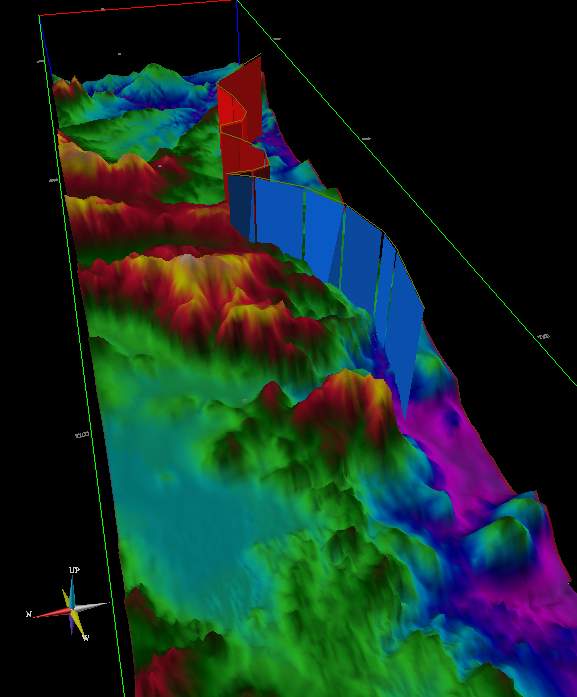
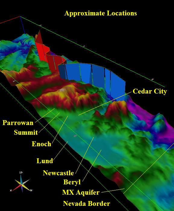
MX Missle (West Valley) Aquifers(see pages 2, 6, 13, 17, & 18)Image below shows much flatter pipeline topography from Wah Wah Valley, Pine Valley, and Hamlin Valley to Cedar, providing respectively 12,000 ac-ft, 15,000 ac-ft, & 10,000 ac-ft. Budget: $150 million pipeline + drilling & pumping costs. $20K/ac-ft * 37K ac-ff * 50 years = $37 billion value. |
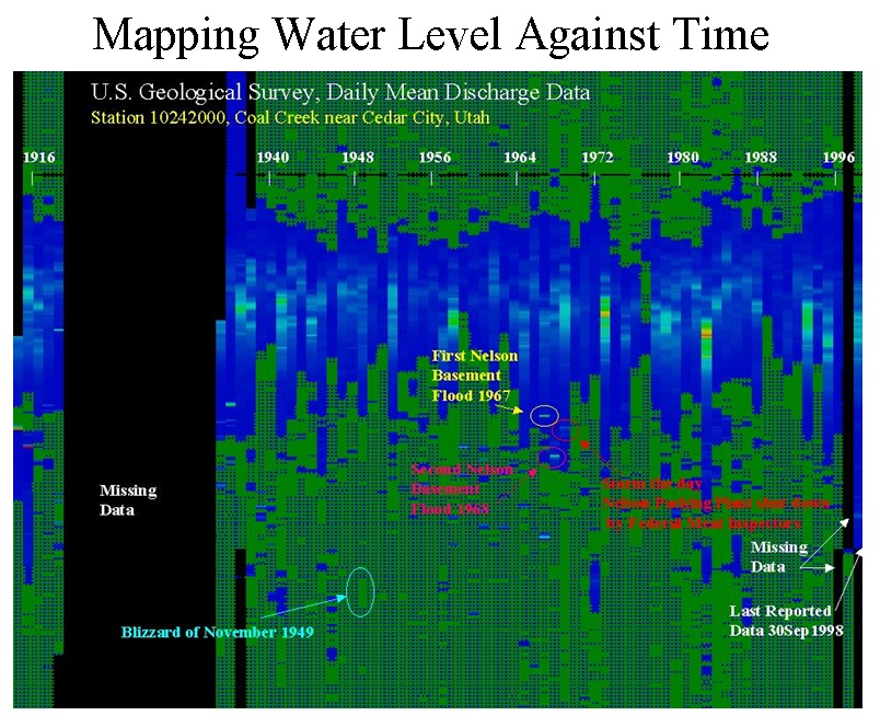
Three Aquifers / Two UntestedImage below shows Coal Creak Water Levels 1916-1998. Imagine making the Coal Creek water level constant, year round, by adding water from the Cretaceous Aquifer, starting with a well at Woods Ranch, and then expanding to produce 25,000 acre feet and feed it into Coal Creek. Maximum budget estimated to be $50 million for drilling. $20K/ac-ft * 25K ac-ft * 50 years = $25 billion value for the Cretaceous + 2x+ this value for the Quartz Monzonite. |
 |
 |
 |
![]()
This page is at: http:www.walden3d.com/IronCounty/ig/IronCounty/IC_3_Approaches.html