. . . Southern Great Basin Under Normal Hydrostatic Pressure
![]()
![]()
What is hydrostatic pressure?As water is stacked in a column, the weight of the waterincreases pressure with depth. If pressure is less than normal hydrostatic pressure, it implies the basin is not closed, has high lateral permeability, or there is drainage. There is no evidence of overpressure in the SW Great Basin. |
How do you measure hydrostatic pressure?Pressure is measured with gagues, and in oil field drillingmonitored with mud weight. The heaver the mud, the more the pressure at depth. Pressure can also be determined from DST (Drill Stem Tests). The Utah portion of the Great Basin is significantly underpressured compared to other Utah basins. The top right map shows the wells included in the hydrostatic study, which is linked to each of the titles listed above. |
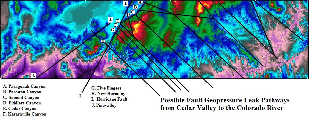
Why is the southern Great Basin underpressured?The basin is not closed. The basin has the same highly porusand laterally permeability Cretaceous rocks - which creates the untapped aquifer up Cedar Mountain - at depth. The hurricane fault has maximum thrown at Cedar City (4,000+ feet - Utah Geological Survey Field Trip - 2014). The basin is not closed. There are major faults, shown on the bottom map below, which faults are conduits draining into the Grand Canyon. 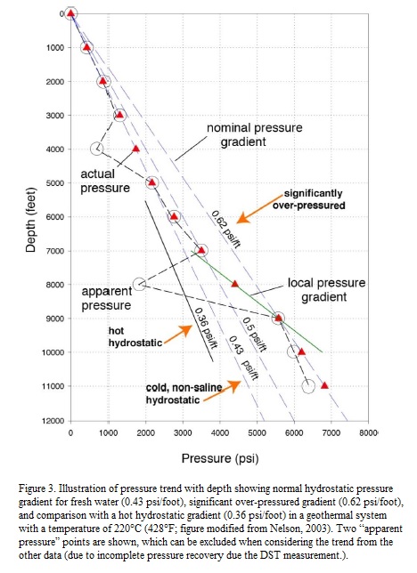 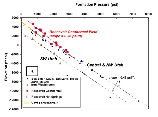 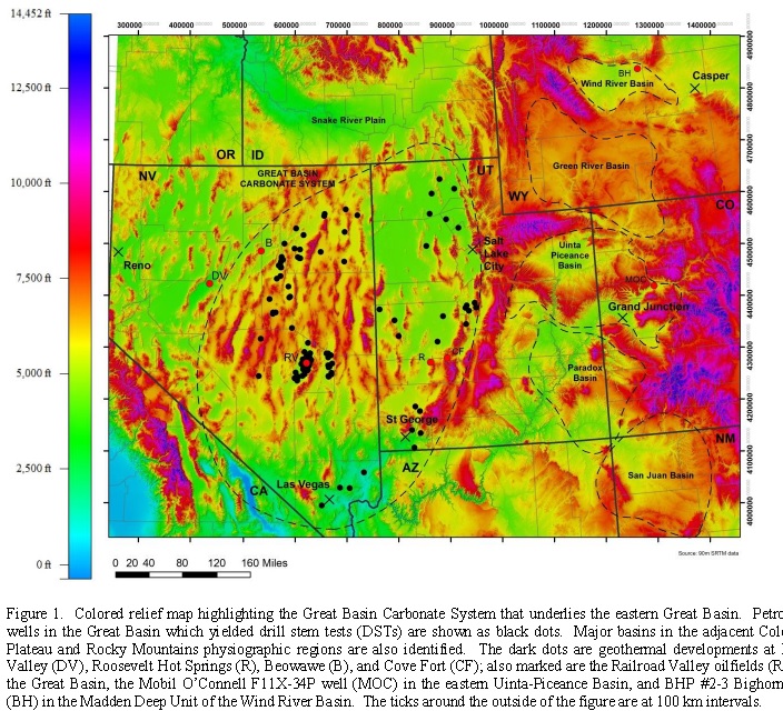
 |
![]()
This page is at: http:www.walden3d.com/IronCounty/ig/IronCounty/IC_Under_Hydrostatic_Pressure.html