. . . Quartz Monzonite Aquifer
![]()
![]()
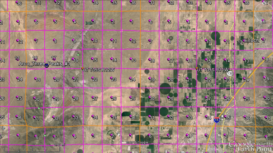
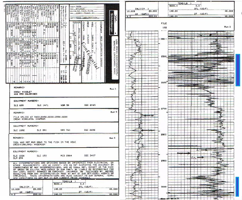
Existing Arco-1 Well LocationThe Arco #1 was plugged and abandoned on 08 March 1985.This well was drilled to 11,640 feet. Pressure was less than normal hydrostatic pressure, likely because large faults drain water from the basin to the Grand Canyon. |
Arco #1 cuts fractured Quartz MonzoniteThe Quartz Monzonite intrusion runs from Pine ValleyMountain to Minersville. The iron settled out as the intrusion cooled and the Quartz Monzonite fractured. The fractures are from 2,490-2,620 feet and from 2,960-3,050 feet. Because the well goes to 11,640 feet, it goes through both of these fractured intervals. |
Arco #1 can be reopened to test the QM AquiferSince Arco #1 is already drilled, the plugs can bedrilled out, and the aquifer potential tested. With water in Southern Utah selling for $20,000/ac-ft, if the well produces 1,000 acre-feet per year, it will have a value of $20 million per year. This water eventually would end up in the Colorado River. The idea is to only produce equivalent to annual rainfall from the area produced. |
 |
 |
 |
![]()
This page is at: http:www.walden3d.com/IronCounty/ig/IronCounty/IC_QMA.html