|
Technology is key to reduce costs in the development industry.
W3D and the NetWork have numerous technologies which will be brought to bear on the Deerwood Project.
Some of these include:
- W3D has developed check-lists for site evaluation and project design:
- Data and Patterns: W3D has developed procedures to extract information from commercial and public domain databases to guide planning and development. W3D also has data mining and pattern finding technologies, which enable understanding all of this data.
- Physical Characteristics: Although each site is different, the basic concepts necessary to develop all sites are similar. All housing is built on some kind of geologic foundation. There is a natural environment at all sites, which can either be incorporated into or hidden through the design.
- Urban Characteristics: People interact with other people. The more people, the more urban the environment. Understanding and incorporating these interactions into the design facilitates usability.
- Exceptional Amenities: If every multiple families share amenities, like exercise rooms or swimming pools or pool tables, it is logical each family will be able to afford more amenities. Planning and computer aided scheduling will minimize cost and maximize use.
- W3D's Design Process optimizes time and space and materials and functionality:
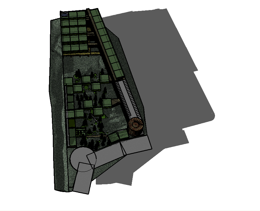
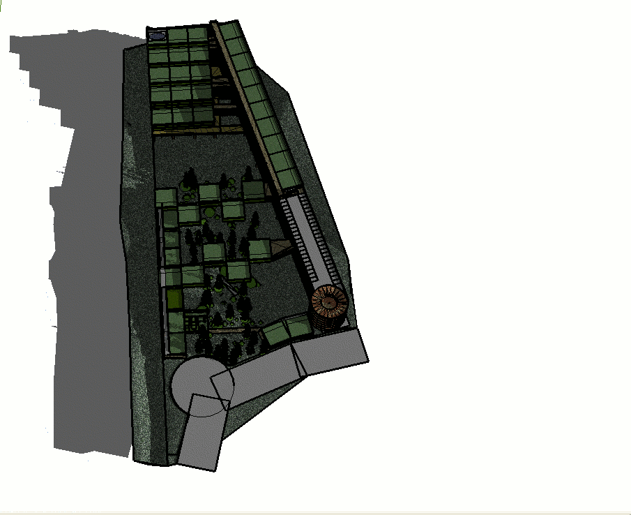
- To demonstrate technical competence and relevance, a first pass design has been built for a housing complex using concepts Walden 3-D has identified as relevant to achieve the highest and best use of the 7 1/2 acres at 0 Deerwood Drive.
The following points summarize why this model was developed and link to different views of the model for Deerwood Village:
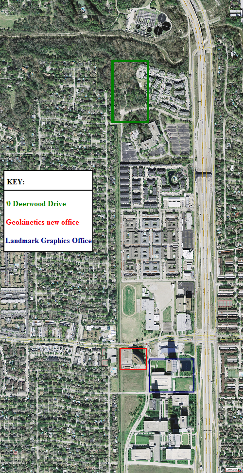
- Geokinetics, where Roice Nelson has worked from August 2003 to September 2007, is moving to 1500 City West Boulevard in October 2007. Landmark Graphics, a company Roice co-founded, is located in the same complex of buildings. And Ion, a geophysical provider of seismic acquisition equipment is located at the same complex. The three company facilities are within walking distance of 0 Deerwood Drive, (see Key Map of the Area) and are a good market for the proposed development. It would be interesting to take the Sketch-Up models and to display them in Landmark Graphics Real-Time Operation Center, a 3-D visualization center.
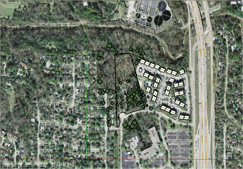
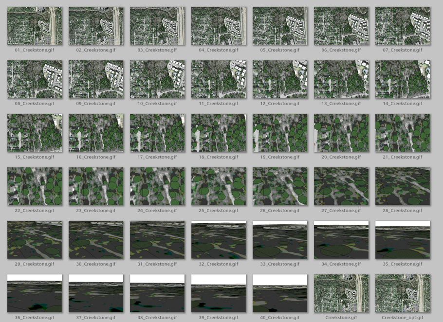
- In the early 1990's, after participation in a Walden 3-D NetWork Planning Session, Alf Klaviness took Roice to the site of a former Mexican Restaurant as a possible site for a W3D type facility. There was a lot of smell from the sewage treatment plant across Buffalo Bayou and the opportunity was not pursued. The smell was cleaned up, and Creekstone Apartments were built on 10.5 acres of the 17 acres (see animated map view of Creekstone Apartments, thumbnails, and individual animation frames). Note how the apartment design is driven by providing parking next to each unit, and note how much difference there is in the amount of cement compared to the undeveloped state of 0 Deerwood Drive. The trees in these photos are interpreted from the air photo.
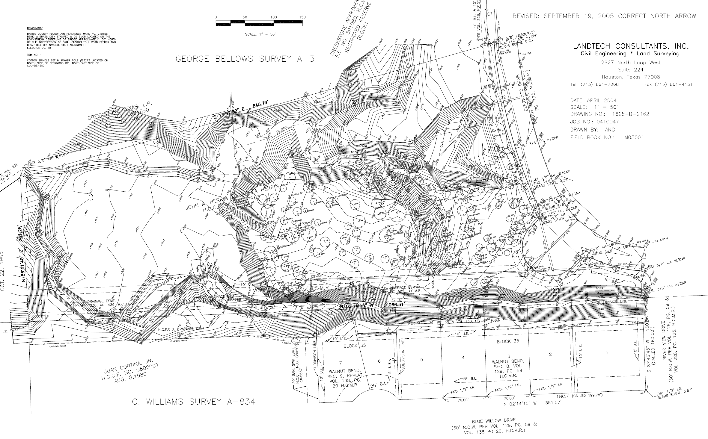
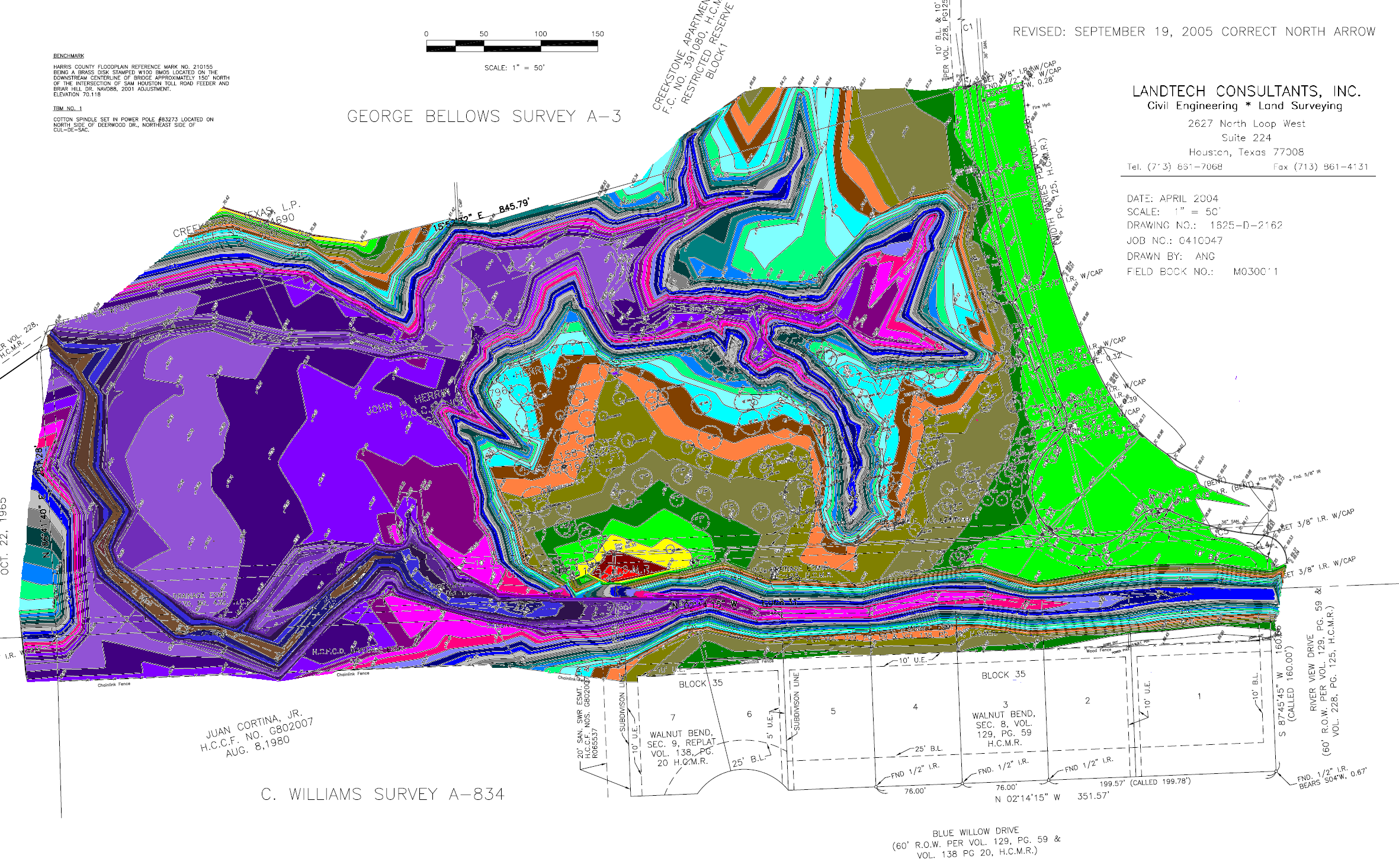
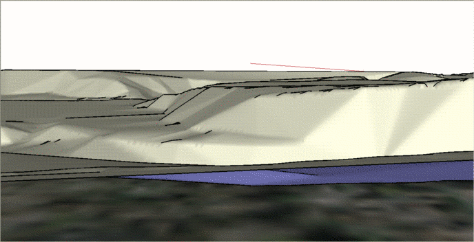
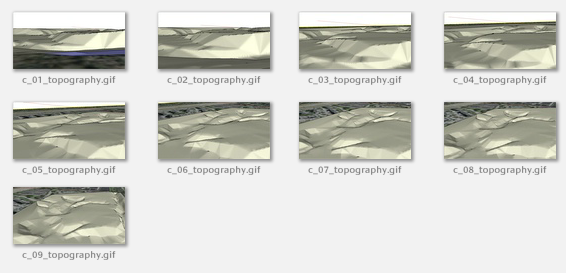
- Of the 7 1/2 acres at 0 Deerwood Drive, over half is in the Buffalo Bayou flood plane, as shown on the topography map (see survey, colored survey, 3-D surface representation, animation, thumbnails, and individual animation frames). The model W3D put together converts this negative to a big positive, demonstrating how a to meld infrastructure with nature to the benefit of both.
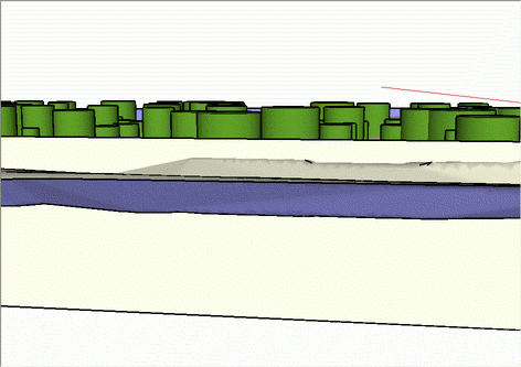
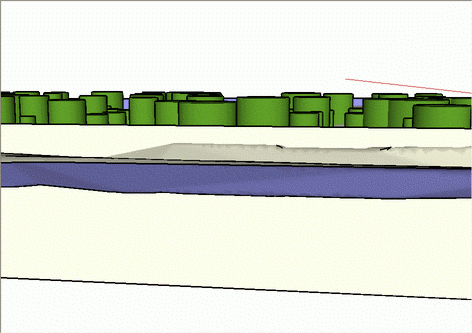
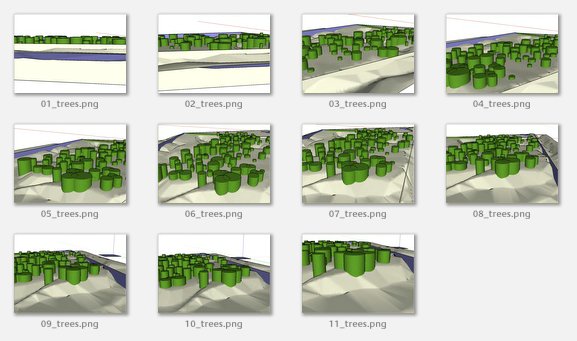
- The survey map has the lateral extent of the trees drawn on it. The extent of these tree coverage areas can be "grown" to three-dimensions from the digital representation of the the topography (see tree coverage, animation, thumbnails, and individual animation frames).
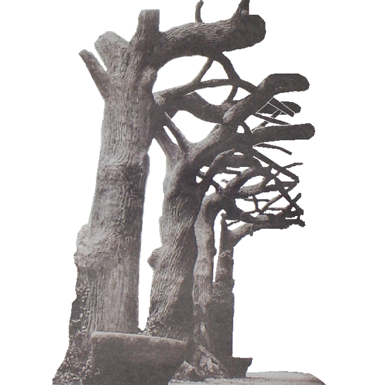
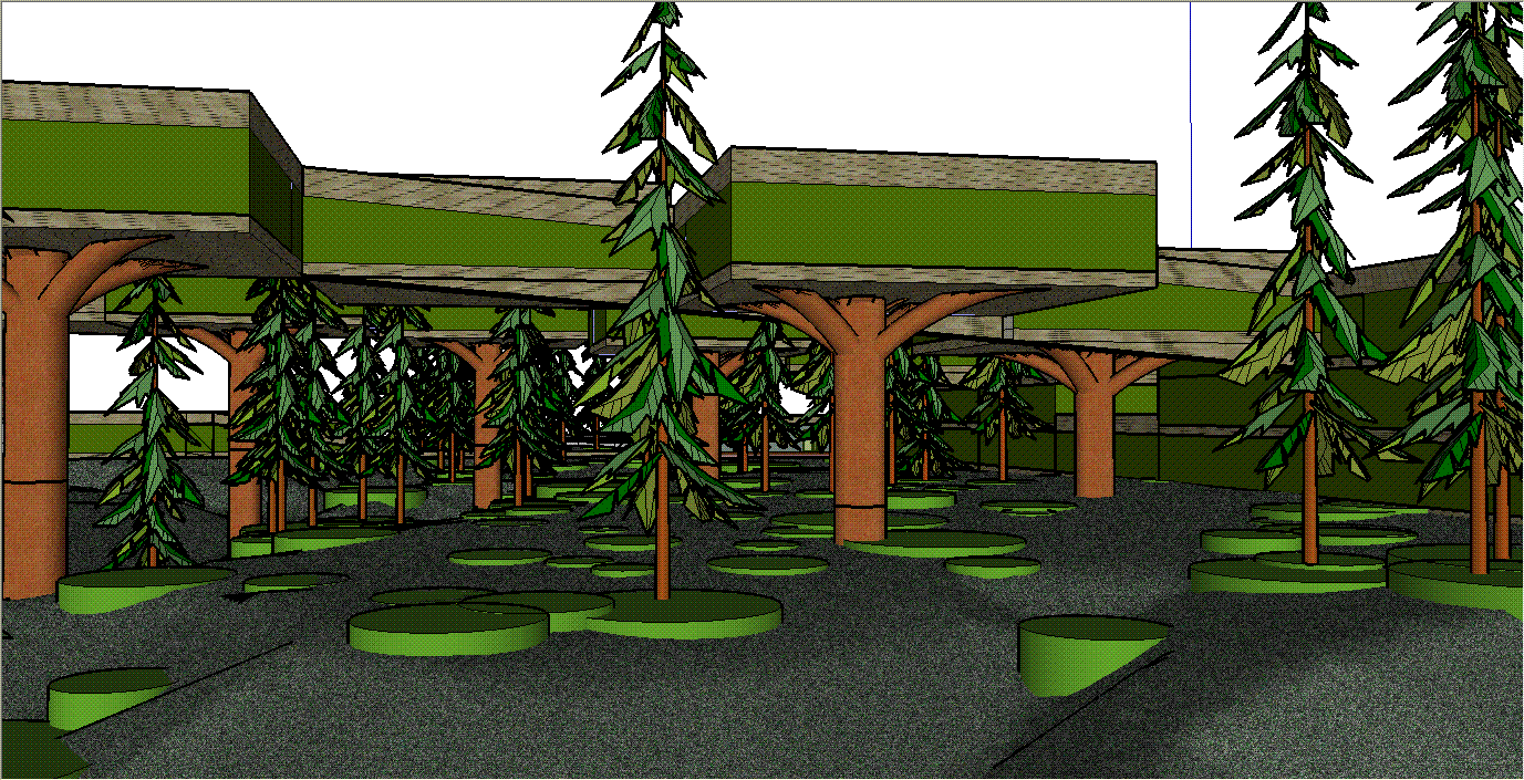
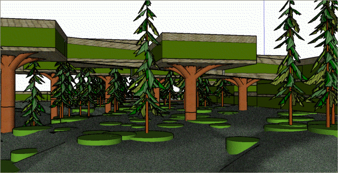
- One of the issues in building in places like 0 Deerwood Drive is the potential for flooding. One way around this issue is to build up, and to leave the ground cover as natural as possible. One way to do this is to build houses on cement trees, which is an art form and technology unique to Houston, Texas (see cement trees). These cement trees can provide elevator access, as well as access to gray water, hot and cold drinking and bathing water, electricity, gas, sewage, trash removal, automated package delivery, etc.
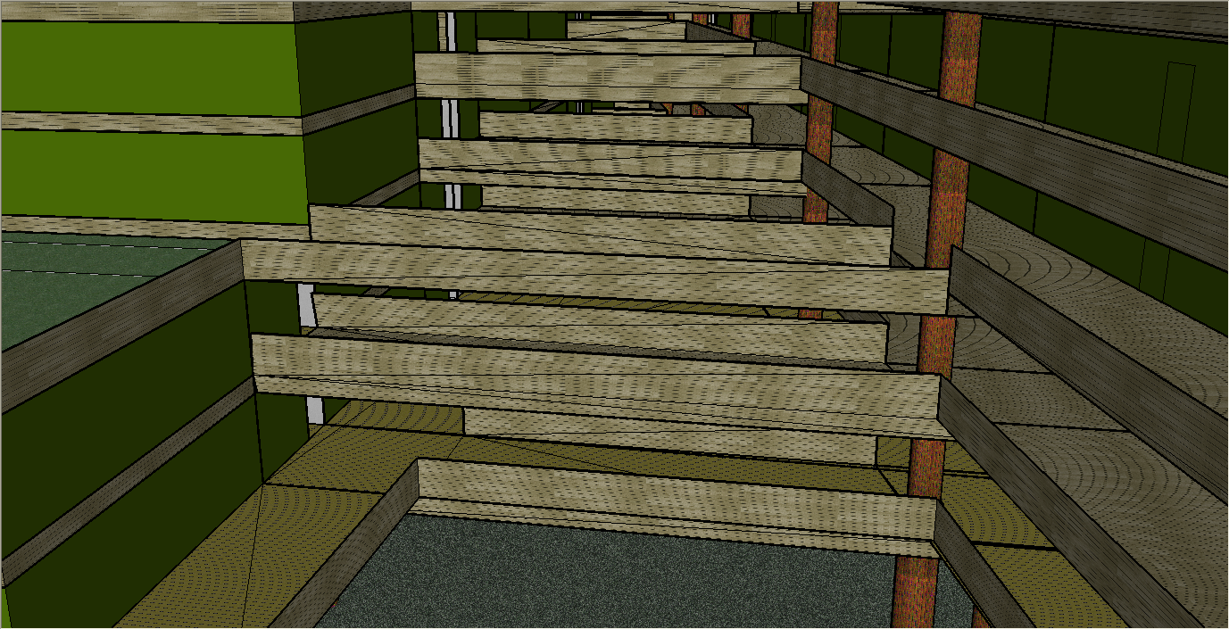
- This first pass design is meant to capture how the beautiful natural environment at 0 Deerwood Drive can be captured and retained with a reasonable size population living on the site. One way to do this is to build tree houses (see Tree Houses, animation, thumbnails, individual animation frames). The idea is that cement trees would hold up the housing units, and could even act as input and output channels for house access by private elevators, sewage disposal, etc. When one is walking underneath these trees it would be like there is a thick canopy above them, and the support columns would look like trees, so it enhances the natural environment.
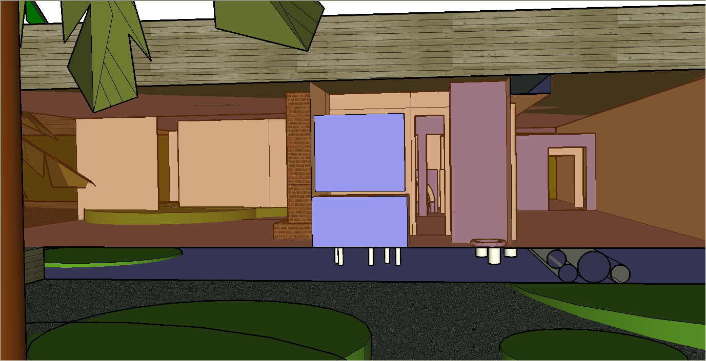
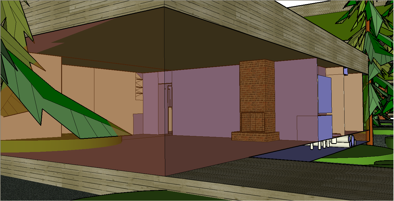
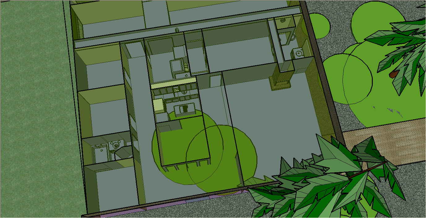
- This first pass design has each housing unit exactly the same size, 50 feet by 50 feet by 10 feet with a 2 foot utility access area underneath the entire house. This is at least twice the floor space per unit as the Creekstone apartments next door. Habitat units can be smaller, larger, and walls and physical layout can be arranged uniquely for each family. The example house has a storage hallway entrance in the back, a storage area, three rooms and a bathroom on one side, with a laundry, kitchen, and dinning room in the middle. Then there is a living room and master bedroom and bathroom on the other side (see side view, living room corner view, front view, top view with lawn roof removed, animation, thumbnails, and individual animation frames). A basic concept here is that these are glass houses, with industrial strength cladding, like goes on large office buildings, reflecting and making the natural environment look larger to those outside, and providing views of what is happening outside to all inside.
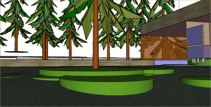
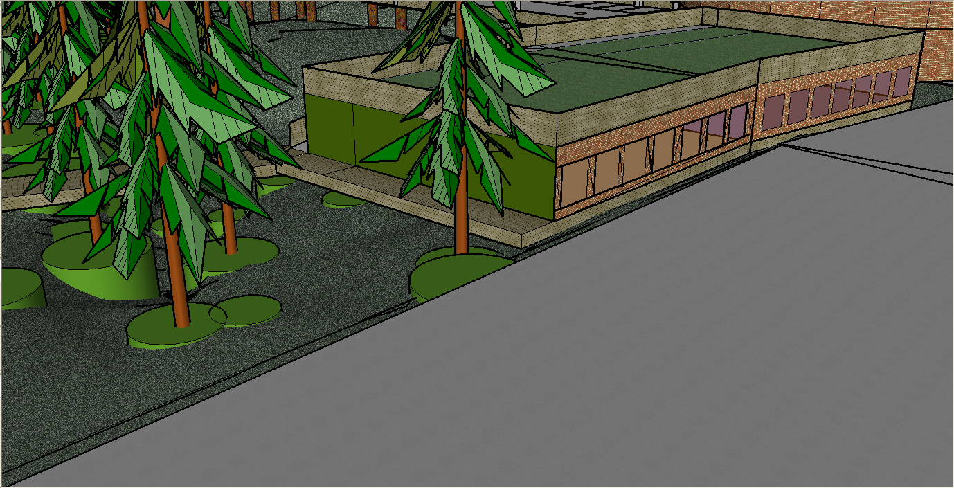
- The community center could be a restaurant (see Community Center, animation, thumbnails, and individual animation frames). This site is located in the middle of some of the best restaurants in the world. It seems reasonable to make arrangements with these restaurants to let folks order from their menus, and to have the meals picked up from these restaurants and served at this restaurant. It is located next the garage so it can be available to folks not living in the community, and provide a source of income for maintenance and operations of Deerwood Village.
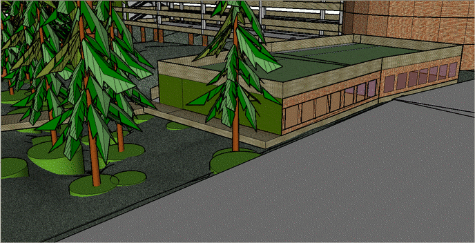
- Even though the idea is to build the community around people instead of around cars, in Houston Texas cars are essential. So a garage for residents and visitors is integrated into the design (see garage, animation, thumbnails, and individual animation frames). A couple of things related to this the garage design:
- The community will be self-contained, and for those who work in the BMC office complexes it is within walking distance to work. Shuttle buses can provide transportation to other key employment sites. Many folks interested in this type of housing will telecommute. The bottom line of all of this is that many residents will not need an automobile.
- There are numerous automobile rental agencies close to the site, and it is reasonable to assume community discount arrangements can be made which will allow access to a modern well serviced car when one is needed. This eliminates maintenance and other issues for those who choose this option.
- The community is across Buffalo Bayou from bike trails that go from Katy to downtown. A bicycle bridge across the bayou will provide access to this excellent form of exercise and self-propelled transportation.
- For those not interested in exercise, the community could be built for access with a Segway, 2 wheel balanced transportation device.
- The initial design only calls for one main set of elevators, in the center of the circular ramp to various parking levels. Deliveries of large items, and moving in and out of the housing units would be via this elevator. This is similar to the way housing works in multi-story condominiums.
- One thing the design team needs to consider if this project proceeds, is the impact of night lights in the garage on the Creekstone Apartment complex. The tall buildings are on this side of the site, to minimize the visual and intrusive impact on traditional housing across the drainage ditch to the west.
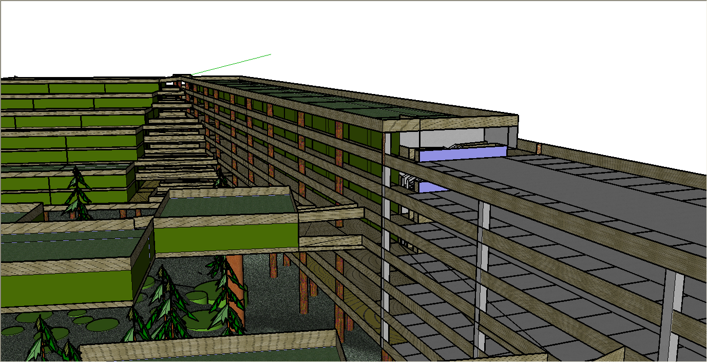
- The main complex is 10 units by 7 floors of 2,580 square foot units, or 70 units with boardwalk access in front, and hall access in the back. At half the unit size, still much larger than most of the Creekstone Apartments, this would be 20 units by 7 floors of units, or 140 units. At twice the size, this would be 5 units by 7 floors, or units, each 35 5,160 square feet (see main 70 unit complex, animation, thumbnails, individual animation frames). The idea is to have some basic similarities between the units, so they can be designed in a visualization theater, pre-fabricated off-site, and quickly assembled or rearranged on-site.
- The back units are similar, only denser. There is a 7 story stack of 3 adjacent units in the back, then a six story stack of 3 adjacent units, then a 5 story stack of three adjacent units, then a 4 story stack of 3 adjacent units, and finally a 2 story stack of 3 adjacent units. The bridges connecting the main unit and this section have atrums open to the ground (see bridges and connections to nature and the back space). It is easy to imagine catching rainwater on the roofs, and creating waterfalls that flow down the center of these atriums, creating a beautiful experience. The housing on the west is kept low, because of the housing just across the drainage ditch to the west (see housing neighborhood side, and thumbnails). However, this housing is designed to connect to the tree houses across the center of the site, which also connect to the main unit or to the garage.
- One assumption is that most folks purchasing housing here will want to have windows looking at the wonderful natural environment at this site. Therefore the 11 units in the center section of this back section, where the units have no windows to the outside, might be used for centralized heating and cooling, maintenance storage areas, stores, offices, a bowling alley, weight rooms, pottery shop, woodworking shop, computer rooms, game rooms, basketball or badmitten courts, or other community amenities. Ideally once there are a critical mass of homeowners, they could decide what direction they want to take the community.
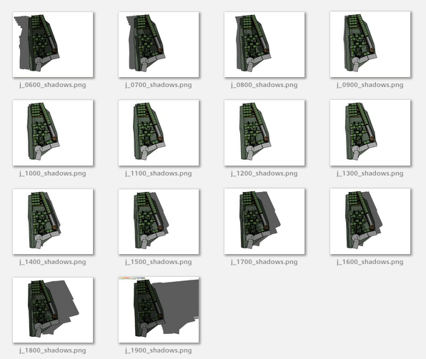
- Modeling technologies have greatly expanded over the last few years. This includes modeling the strength of materials, how sound proof a design is, moving water and air throughout a complex like this, as well as weather models, like how well the complex will stand up with a major tornado or hurricane, which direction the wind is coming from, where and when to plant gardens, and available sunlight at different times of the year and different times of the day. Many of these models are available to designers. Others can be contracted from university research groups for minimal expenditure, and most of them can be used to optimize the design before any construction occurs (see model of sunlight, animation, thumbnails, and individual animation frames). Once the facility is completed, models will also help in optimizing maintenance, storm repairs, etc.
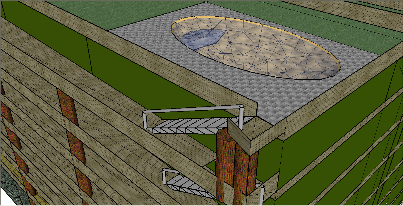
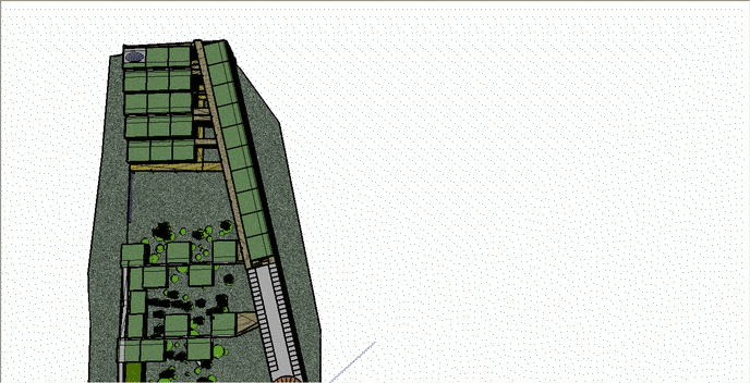
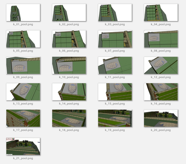
- A community swimming pool needs to be visible, and so this amenity was selected to illustrate exceptional amenities (see pool and other amenities, animation, thumbnails, and individual animation frames). Numerous other possibilities have been described, albeit briefly, in this section.
- Once a business relationship is established (see proposed to John and Carola Herrin), and once initial seed capital for design and development is available, the first step will be to bring together appropriate members of the NetWork for a 3 day site visit and planning session. Plane tickets and housing for Raymond Gardner (architect), Mic Patterson (design build), and Rick Duran (economics); $1,600. per day for profession services these three folks and for Merril Littlewood (accounting), Ed Rogers (legal), Lyle Rowbury (contracts), Roice Nelson (general contractor), and others who will not be paid; plus renting a meeting facility will cost about $15,000. This meeting will formalize the project business plan, setting out goals and milestones.
- W3D's Infinite GridSM or n-dimensional spatial indexing technology will be used to:
- Provide a new class of Project basemaps for tracking everything from the density of mosquitoes at various elevations above the standing water which can occur when Buffalo Bayou floods to density to plants and habitats (birds, alligators, possum, etc.).
- These maps can be put as the background in a standard spread-sheet and provide an inexpensive and effective GIS (Geographical Information System) spatial calculators.
- Project progress will be posted on-line in real-time, protected by passwords, and available for monitoring and review and update by members of the NetWork and by Investors and Stakeholders from wherever they are working.
- W3D's Knowledge BackboneSM process indexing technology will` be used to build and maintain and upgrade Best Practices. This will become particularly useful to Investors as additional related Project(s) are taken on.
|

