|
... II. The Framework ...
values

 paradoxes
|
Models
Specialization requires the concurrent use of many kinds of maps. The geotechnical projects
described above use many different types of data. An important concept is that the visual integration of all of these different types
of data creates a model. Models are dynamic, and can be built so as new data or information or knowledge are uncovered, it can
be automatically incorporated into the model. Models extend our mind, because there is so much data in almost any area of
specialization, it becomes impossible for most of us to keep all of the data in our mind and also keep it simultaneously sorted
into useable chunks. The common space and locations within a model enables understanding and communication. Patterns,
and thus information, knowledge, and wisdom, naturally fall out of concurrent appraisal of multiple maps in a model. Models
start with one data set, then they add the next, then the next, and soon many users are collaborating to build and enhance the model.
By building context in the models, one piece of data at a time, it naturally creates new knowledge within this context. With the
proliferation of computer technologies it is logical that these integrated models will become the modern replacement for maps.
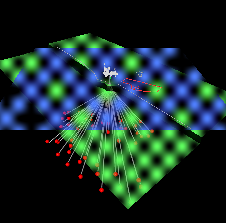
In 1998, I was approached about helping optimize the location of a drilling platform in the
Caspian Sea. A subcontractor of Energy Innovations, Angus Jamieson, had expertise and tools to solve this problem. After
building a model of the bathymetry (subsea topography), identifying the original planned location for the platform, adding these
data to a model including all of the hydrocarbon target locations, and determining how many slots were available to put drill pipe
down on the drilling rig, the OilPlanTM software simulated and optimized the relationships between targets and
how to best allocate the slots to reach the most number of targets (see Figure 34). The estimated savings from this modeling
process was almost $30,000,000. And this result could be further enhanced today by using modeling to also optimize the
number of platforms necessary to produce from the number of exploration targets.
It has been fascinating to watch and to participate, at least peripherally, in the development of these
modeling technologies. Immersive models are a living representation of now, in that they provide a picture of things in the past, our
understanding of things at the current time, and sometimes, the models even provide a projection of what to expect in the future.
Interacting with these intelligent models enables understanding. It is also interesting that just as human physical systems - our cities
and our houses and our roads - are built on geology, many of the initial immersive models were likewise built on geology.
|
timedex
infinite grid
-097-
|