. . . - . . .  . . .
. . .
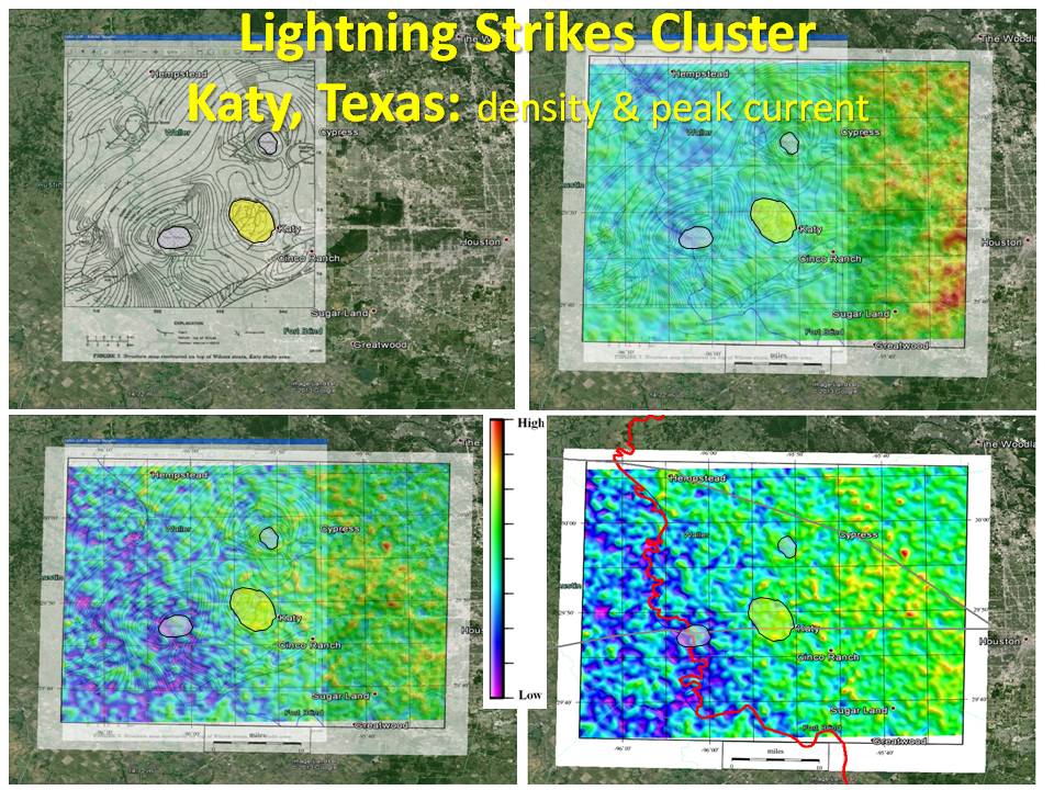
Lightning strikes cluster. A legacy map of the Top Wilcox formation was found for the Sealy Salt Dome, Hockley Salt Dome, and Katy interdomal structurei and is shown on the upper left image. Lightning Density (upper right) and Peak Current (lower left) were overlaid semi-transparently so the contours still show through. The patterns in the lightning maps follow the same trends as the depth map. When the Peak Density map is made solid and the Brazos River is overlaid (lower right), there is an obvious difference in lightning strike attribues on either side of the river. I believe the reason the Brazos River is straighter and faster than the Colorado River 60 miles to the west is because it follows an old Cretaceous transform fault, and the attribute differences are related to the geology.
|