|
... II. The Framework ...
values

 paradoxes
|
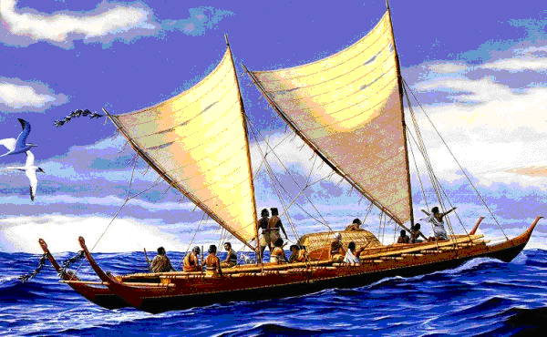
Figure 26. Polynesians settled the vast Polynesian triangle by 700AD (Art from the Bishop Museum depicting early Hawaiian canoes, provided for public,
educational use.2.74).
Maps
For an exploration geophysicist, maps are the key integrator of any project.
So it was with no small amount of trepidation preparing and presenting a presentation several times to
professional colleagues in 1999-2001 titled “The Impending Obsolescence of Maps.” In preparing this
presentation, I spent a lot of time studying maps, reading books about maps, and coming to a new understanding
about the importance maps have had, particularly from the foundation of the British Empire up to our modern society.
Maps are in the same class as books, both consequences of the invention of the printing press, in terms of their
impact on the creation of our modern society.
According to the 1910 Encyclopedia Britannica “A map is a representation,
on a plane and at a reduced scale, of part or the whole of the earth’s surface.” It is often not recognized how
European colonization succeeded based on ownership maps. The map became more than directions of how
to get from one place to another place. The map became a legal definition of the meets and bounds of a piece
of property. Maps defined farms, ranches, counties, and countries. These projected two-dimensional flat
reproducible representations of an area or a territory defined ownership.
|
timedex
infinite grid
-084-
|