. . . - . . .  . . .
. . .
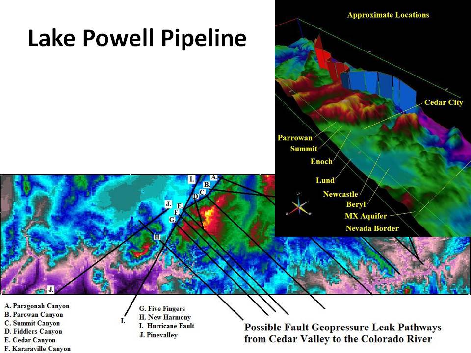
The insert shows a perspective display of the topography with a red fence where The Lake Powell Pipeline would lift water and a blue fence where the pipeline would flow downhill. The 2,000+ rise from Hurricane to Cedar City is not highlighted. However, the minimal elvation of a pipleine between the MX Aquifer and Cedar City falls out of this display. These displays were prepared for Eldon Smoots, who was a proponent of The Lake Powell Pipeine and running The Central Iron County Water Conservency District. Iron County's participation in The Lake Powell Pipeline was later cancelled by a vote of the citizens of Iron County.
|