![]()
Society works around (x,y,z,t) point space-time indices, i.e. longitude, latitude, depth, elevation, distance, time, or their equivalent. These are each points in the space-time continuum. For example, ownership is typically defined in terms of a series of corners (longitude, latitude) connected to form a polygon. Likewise, time is a single point. Walden 3-D, Inc. proposes area or interval space-time indexing, with the goal of this becoming an invisible (thanks to computer translation) way of finding where and when things happen, and as a platform from which to be able to do Boolean operations (such as: and; or; greater than; less than; equal to; etc.) on data which are tied to a specific area or interval in the space-time continuum.
The Infinite GridSM is a simple, and yet very powerful way to keep track of data, information, and knowledge as tied to an area or time-line. Walden 3-D, Inc. is exploring options as to the best way to make this technology generally available and still get a financial return on the investment that has been put into developing the technology. Your suggestions are appreciated. Options seem to be to:
This sample application of using the Infinite GridSM includes the following:
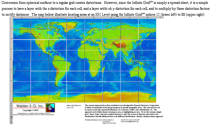
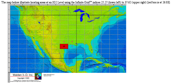
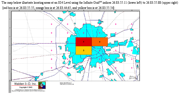
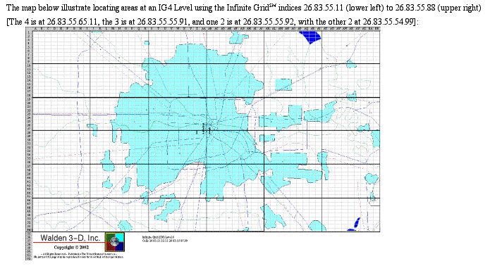
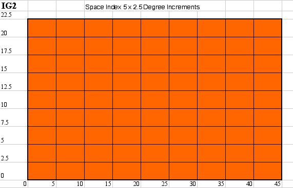
Traditional GIS (Geographical Information System) mapping is based on vectors, connecting adjacent objects (telephone poles, road easements, ownership corners, etc.). The Infinite GridSM is a raster approach, where data from a data base is accumulated in appropriate sized grid cells, or where legacy data is captured by a "sieve sponge" into appropriate sized grid cells in order for Boolean Operations to be performed on combinations of database and legacy paper map derived data. "Appropriate sized" simply means a small enough size to capture all of the data of interest. Grid cells can be decomposed (divided into a smaller sieve size) or accumulated (combined to cover a larger grid xize) automatically. Because this process was developed to assist oil and gas exploration and production, which is a worldwide activity, the grid cells are based on Longitude and Latitude according to the following sieve sizes (distances are approximate and based on Houston's Latitude):

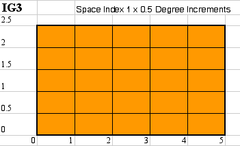
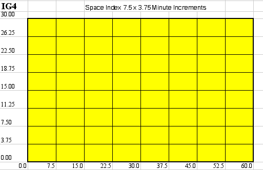
To "see" the relative scales, click on hcig1.gif for worldwide grid cells, hcig2.gif for continent sized grid cells, hcig3.gif for state or county sized grid cells, hcig4.gif for urban area sized grid cells, and hcig5.gif for city area sized grid cells. Alternatively, you can click on the following links for an example of various IG (Infinite GridSM) Levels:
The concept is that this approach is truly based on an "infinite" grid, and so it is easy to extrapolate that grid cells get smaller and smaller, creating more and more grid cells, as scale is expanded. Computer memory and disk access speeds make this a much more resource economical and time retrieval efficient approach to indexing and retrieving geospatial data than using vectors, polygons, and other more conventional GIS approaches. Note Longitude and Latitude are divided up so there is only a 1 digit number for each at any next smaller IG Level.
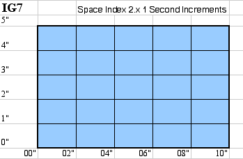
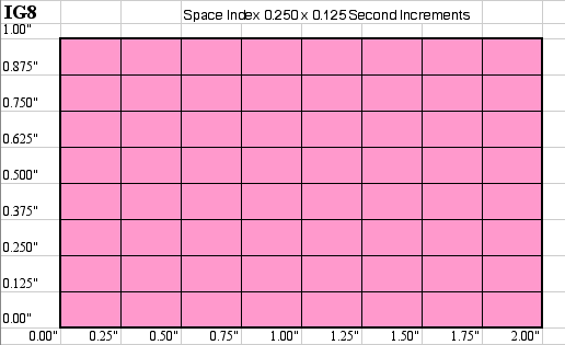
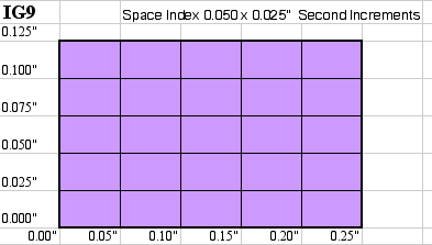
The third dimension is added to the Infinite GridSM by creating a separate spread-sheet, or columns in a database, where one axis is Longitude or Latitude and the other column is depth interval, elevation interval, or other distance interval. The naming of the distance intervals parallels the naminig of x and y axes on the horizontal Infinite GridSM. It is key to determine an origin for the scale being worked with, and the distance intervals needed to be kept track of, and then to hang the grid system off of this origin.
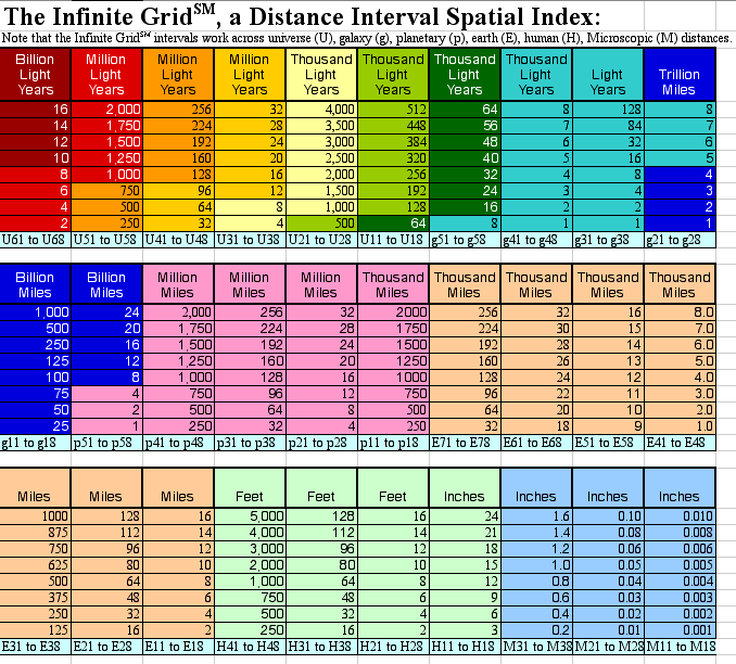
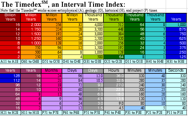
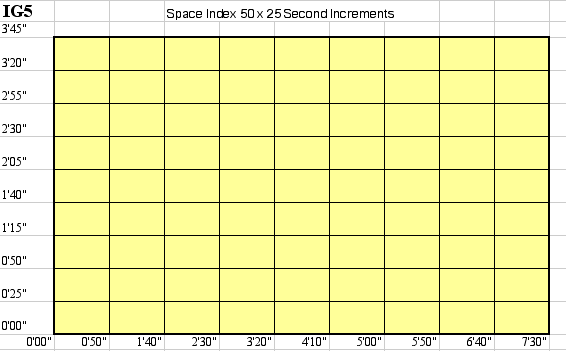
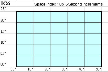
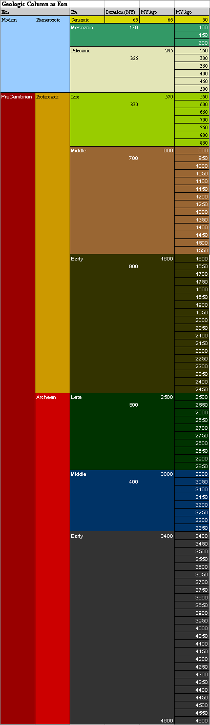
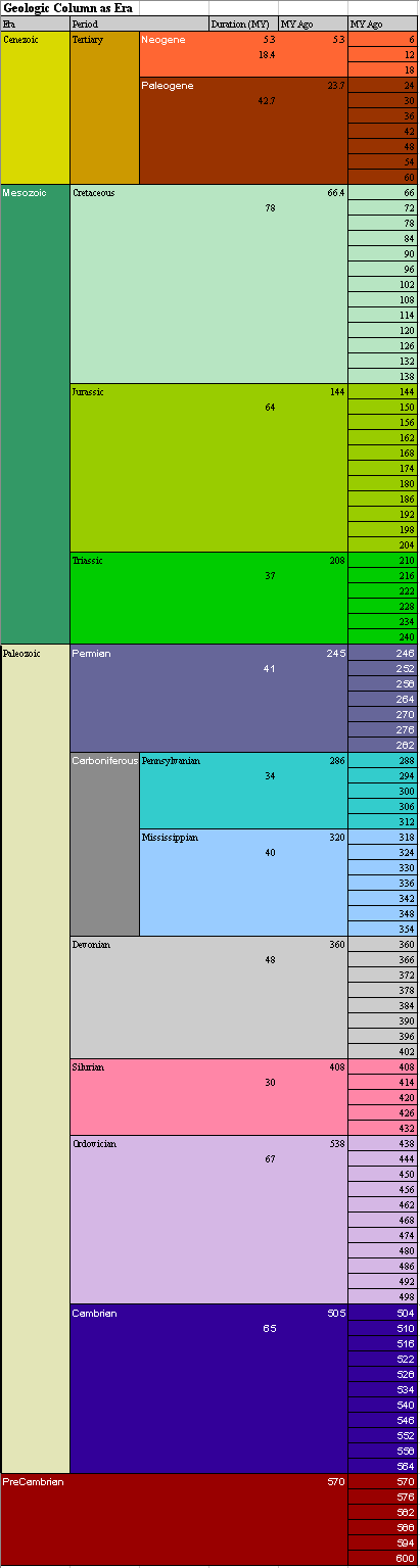
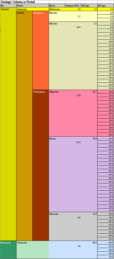
The TimedexSM is a time interval, similar to the distance interval in the third dimension of the Infinite GridSM. There are 18 different "scales" for time, ranging from "Billions of Years" to "Millions of Years" to "Thousands of Years" to "Years" to "Months" to "Days" to "Hours" to "Minutes" to "Seconds" and this can also be infinitely subdivided to measure milliseconds or microseconds, etc. It is key to determine an origin for the scale being worked with, and the timeintervals needed to be kept track of, and then to hang the grid system off of this origin. To date most of the work done, again because of oil and gas exploration and production applications, is tied to the geologic record, and specifically keeping track of the geologic column as equal time increments across Eons (eon.gif), Eras (era.gif), and Periods (period.gif). The same type of indexing can be developed for the milliseconds seismic wavelets are measured in, or the light years astronomical measurements are tied to.
![]()
This page is at: http://www.walden3d.com/H/sample/index.html