|
|
| Dates: | Description: |
| |
| 24Jan03 | First successful e-mails betwen Yan Jia Feng and Roice Nelson. |
| 23Jan03 | Started building web pages located at http://www.walden3d.com/geo. |
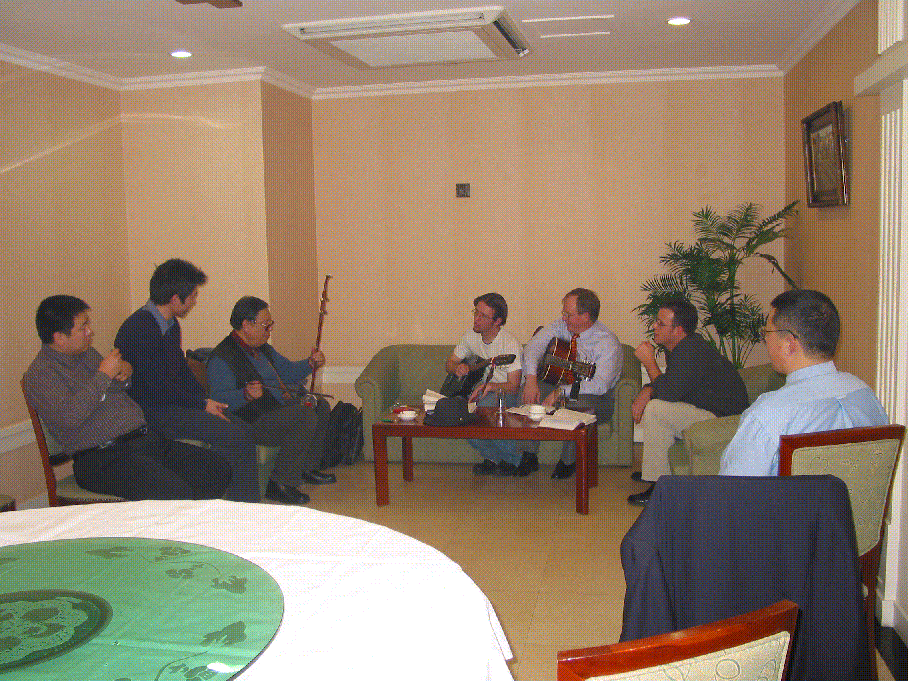
| 17Jan03 | Visit to Vi Iting Cave, 2 hours southwest of Beijing, followed by dinner at The Beijing Duck to discuss Needs and Projects. |
| 16Jan03 | General agreement on philosophy and guitar playing after dinner. |
| 15Jan03 | Roice Nelson's introduction to Depth Migration Services by Lu Xue Xiang and preliminary cooperation discussions. |
| 12Jan03 | Roice Nelson's introduction to Geo by Yan Jia Feng and to GeoTools by Ren Dianxing - a reservoir characterization and reservoir modeling software package. |
| 12Jan03 | Digital Photo Yan Dunshi, Yan Jiafeng, Yan Jialin, Ren Dianxinga, Roice and Ben Nelson, and Brian Penny |
20Nov03
and
25Nov03 | Dynamic Resources Corporation and Beijing XN Geo Energy Science & Technical Development Ltd. signed a Joint Venture Agreement, specifically to:
- Create "Geo China" and "Geo International" as legal entities for doing business together.
- Start business by introducing U.S. Technology into China through "Geo China."
- Identify key western partners and what "Geo China" can sell for those partners in China.
- Enter into recriprocal confidentiality agreements between western partners and "Geo China."
- Sell joint projects:
- Develop a Project Plan:
Meet with Clients, identify their needs, and develop an Opportunity Matrix, specifying what they need and how "Geo China" can meet these needs. The Opportunity Matrix specifies what can be done at what cost. This work is tied to courses, and sales calls. The result is a contract to do a Project Design. There is no cost for the client unless there are courses tied to developing a Project Plan.
- Do joint projects and share profits and expenses:
- Develop Project Design:
The Project Plan Contract specifies who from "Geo China" and from the Client will meet where and when to develop the Project Feasibility Matrix defining what can be done for the client. This Feasibilty Matrix defines the scope, price, cost, deliverables, and the timeline required to build a Basic Earth Model for the Client's specific exploration/production area. Typically this work takes a few weeks and costs US$50,000-100,000. The result is a Project Design, which the Client can initiate internally or contract to "Geo China." If they choose to work with "Geo China," an additional result will be a contract to build a Basic Earth Model for a specific area, play fairway, or field. The cost of this new contract will be a function of the size of project, in terms of area, number of wells, amount of data, and complexity of geology.
- Build Basic Earth Model:
The Basic Earth Model collects all available geological, geophysical, geochemical, engineering, production, economic, and infrastructure data across the project area, organizes this data, and creates a Virtual Reality enabled Earth Model. The costs are tied to the complexity of the the Virtual Reality Model, computer processing time, model building time, and required sophistication of the model, as well as the milestones and deliverables defined in the Project Design Phase. The result is a Basic Earth Model, which the Client can work with, or can contract with "Geo-China" to enlarge and enhance. If the Client chooses to continue to work with "Geo China," a new contract will be developed to Enlarge and Enhance the Basic Earth Model. The cost will be a function of new data, new drilling, new tests, and the results which come from these new data.
- Enlarge and Enhance the Basic Earth Model:
In producing any field, decisions need to be made based on the best data available. Hundreds of cases can be run to realize the maximum ultimate recovery of hydcrocarbons at the most economic price. It is key to identify when the cost to produce equals the cost of the hydrocarbons, for this is when the field or reservoir needs to be shut down. The result of Enlarging and Enhancing the Basic Earth Model is a Better Earth Model, which the Client can work with, or can contract "Geo-China" to use to provide long-term reservoir management. If the Client chooses to continue to work with "Geo China," a contract will be dveloped for Long-Term Reservoir Management. The cost will be a function of production costs and the number of people assigned to the project.
- Long-Term Reservoir Management:
This is outsourcing based on a perdiem per month, and will continue as long as the Client likes the results. If the results are very good, the Client might choose to provide a Production Bonus. If the results are poor, work will cease.
- Based on the success of joint projects in China through "Geo International," seek joint projects outside of China and share profits and expenses.
|
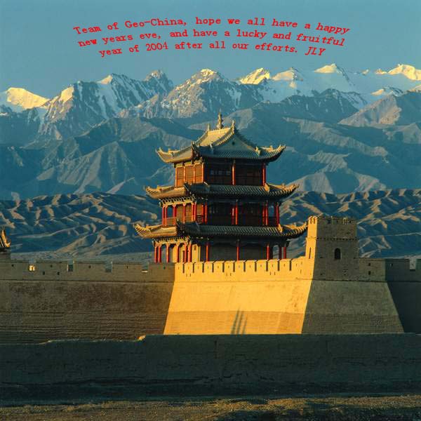
| 31Dec03 | New Years Card from Geo
|
|


