![]()
![]()
The Infinite GridSM is a simple way to keep track of absolute and relative spatial relationships visually and in information space. Traditional GIS mapping is based on vectors, connecting adjacent objects (telephone poles, road easements, ownership corners, etc.). The Infinite GridSM is a raster approach, where data from a data base is accumulated in appropriate sized grid cells, or legacy data is captured by a "sieve sponge" into appropriate sized grid cells in order for Boolean Operations to be peformed on combinations of database derived and legacy paper map data. "Appropraite sized" simply means a small enough sive to capture all of the data of interest. Grid cells can be decomposed (divided into a smaller sieve size) or accumulated (combined to cover a larger grid size) automatically with Dynamic's Infinite GridSM software and database tools. Because oil and gas exploration and production is a worldwide activity, the Dynamic Infinite GridSM is based on Latitude and Longitude according to the following sieve sizes (distances are approximate and based on Houston's Latitude):
| Level | Latitude | Longitude | # Cells | ~ X Distance (metric) | ~ Y Distance (metric) | ~ X Distance (English) | ~ Y Distance (English) | N.A. Grids |
| IG1 | 45o | 22o30' | 8x8 | 1,440 km | 720 km | 900 miles | 450 miles | 2x2 |
| IG2 | 5o | 2o30' | 9x9 | 160 km | 80 km | 100 miles | 50 miles | 10x10 |
| IG3 | 1o | 30' | 5x5 | 32 km | 16 km | 20 miles | 10 miles | 50x50 |
| IG4 | 7'30" | 3'45" | 8x8 | 7.5 km | 3.75 km | 4.7 miles | 2.4 miles | 400x400 |
| IG5 | 50" | 25" | 9x9 | 878 m | 439 m | 1,338 feet | 669 feet | 3,600x3,600 |
| IG6 | 10" | 5" | 5x5 | 175 m | 83 m | 252 feet | 126 feet | 18,000x18,000 |
| IG7 | 2" | 1" | 5x5 | 35 m | 17 m | 106 feet | 53 feet | 90,000x90,000 |
A prototype Infinite GridSM of Earth is at http://www.walden3d.com/E, where 45ox22.5o small images (http://www.walden3d.com/E/EarthSmall.html or large images (http://www.walden3d.com/E/Earth.html), 8 adjacent large images (http://www.walden3d.com/E/E26_9.html), 9x9 decomposition images of a 45ox22.5o grid (http://www.walden3d.com/E/E26/E26EarthSmall.html, or the index for the 9x9 decomposition (http://www.walden3d.com/E/E26/E26.html can be reviewed. An example of integrating legacy data is at http://www.walden3d.com/dynamic/IG/IG3+4_26.83.11-55_AMI012num.gif.
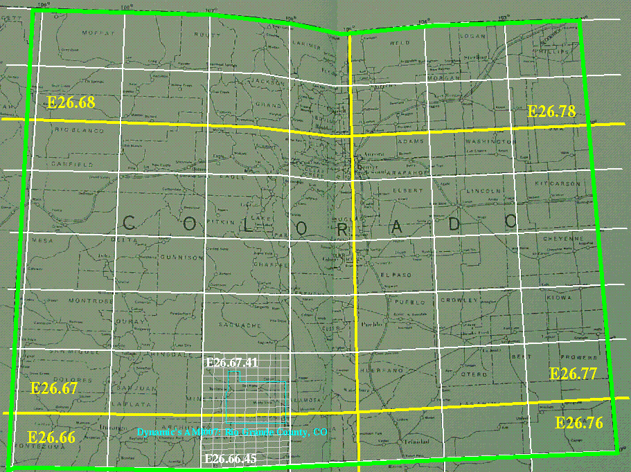
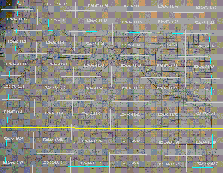
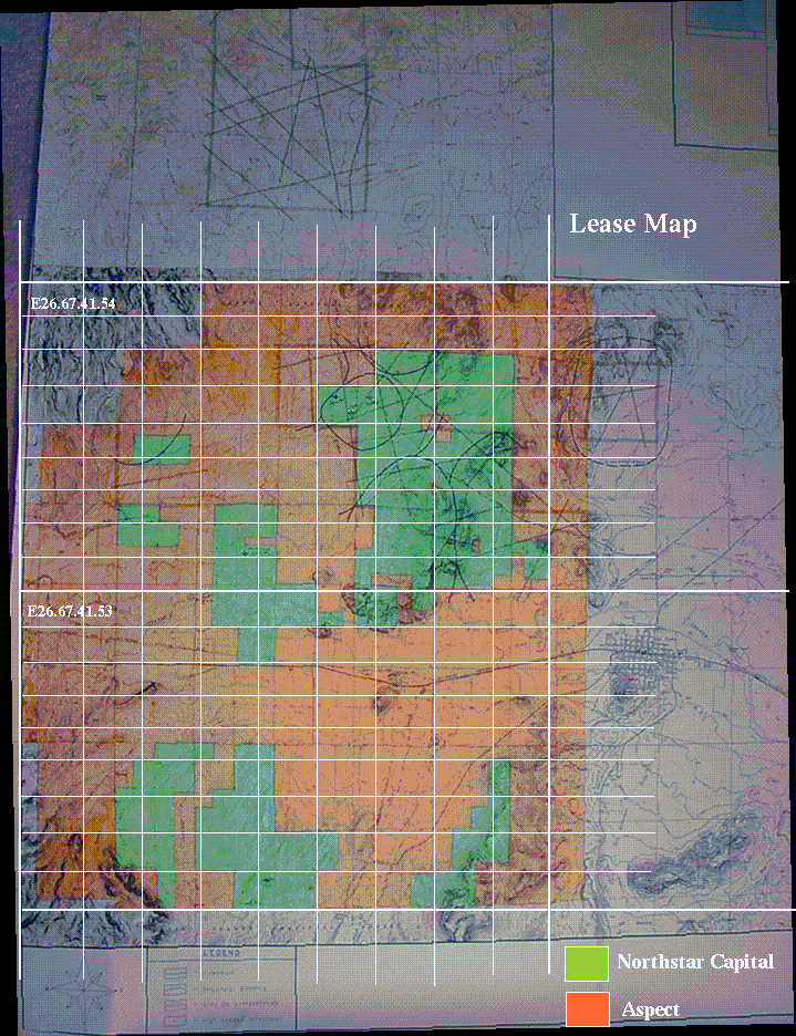
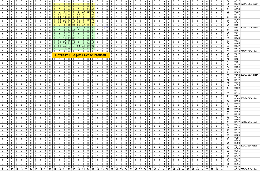
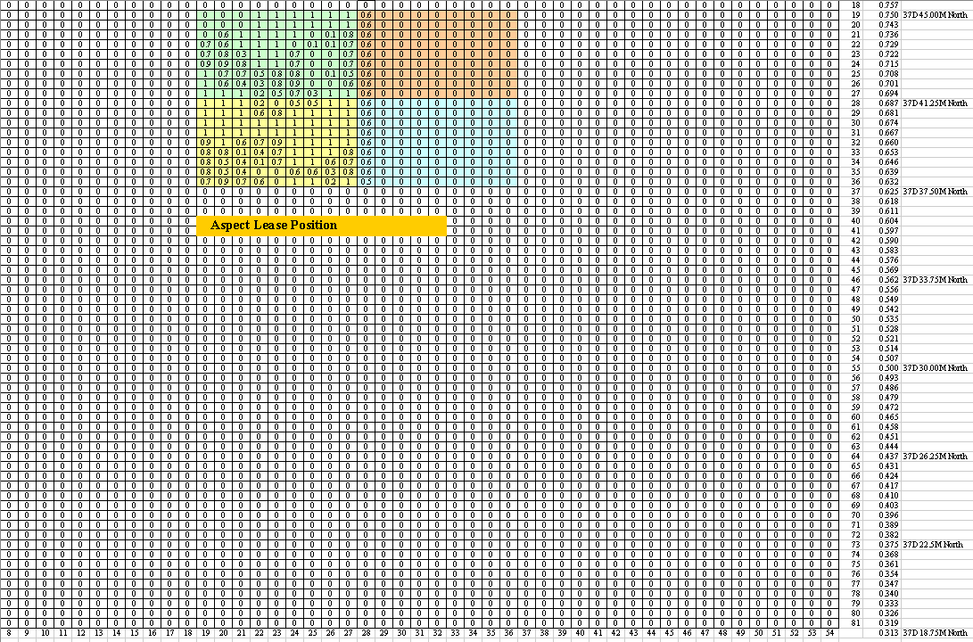
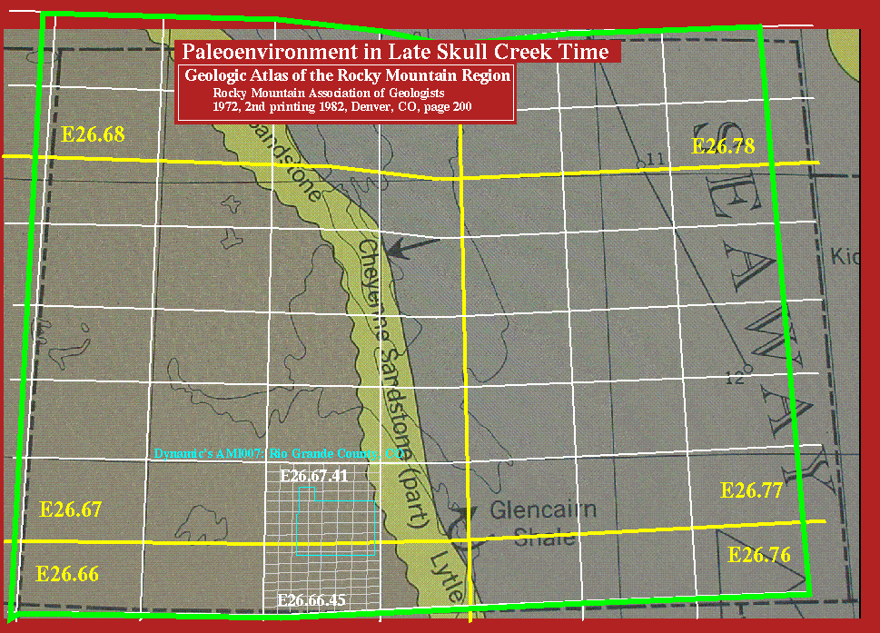
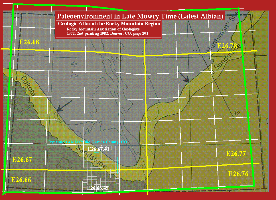
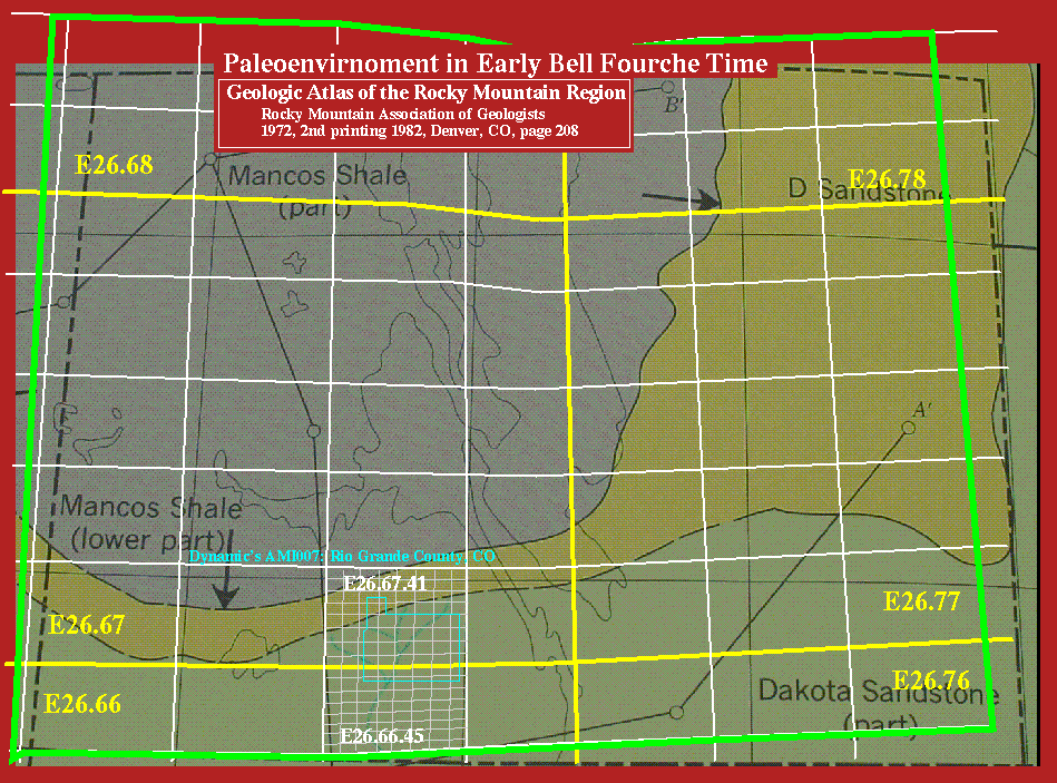
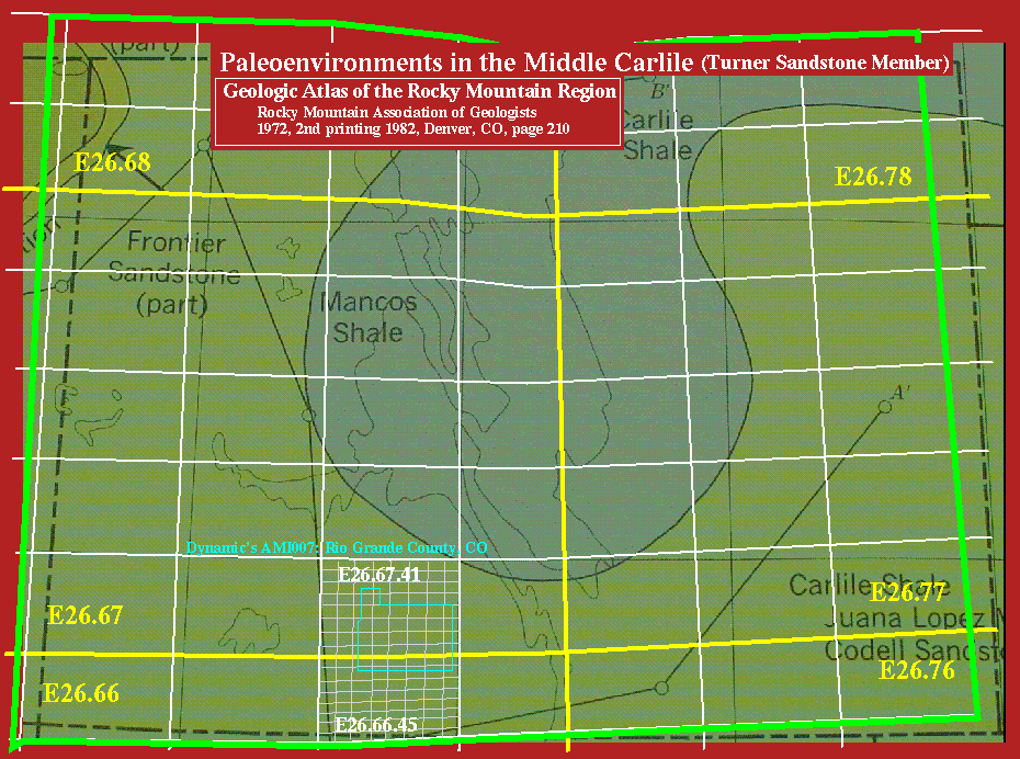
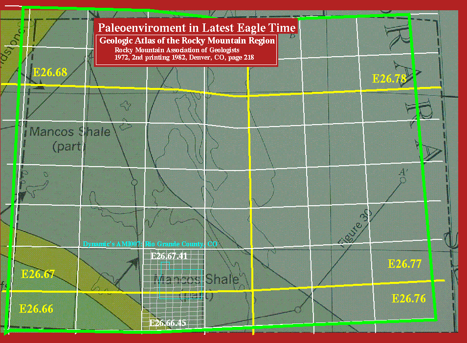
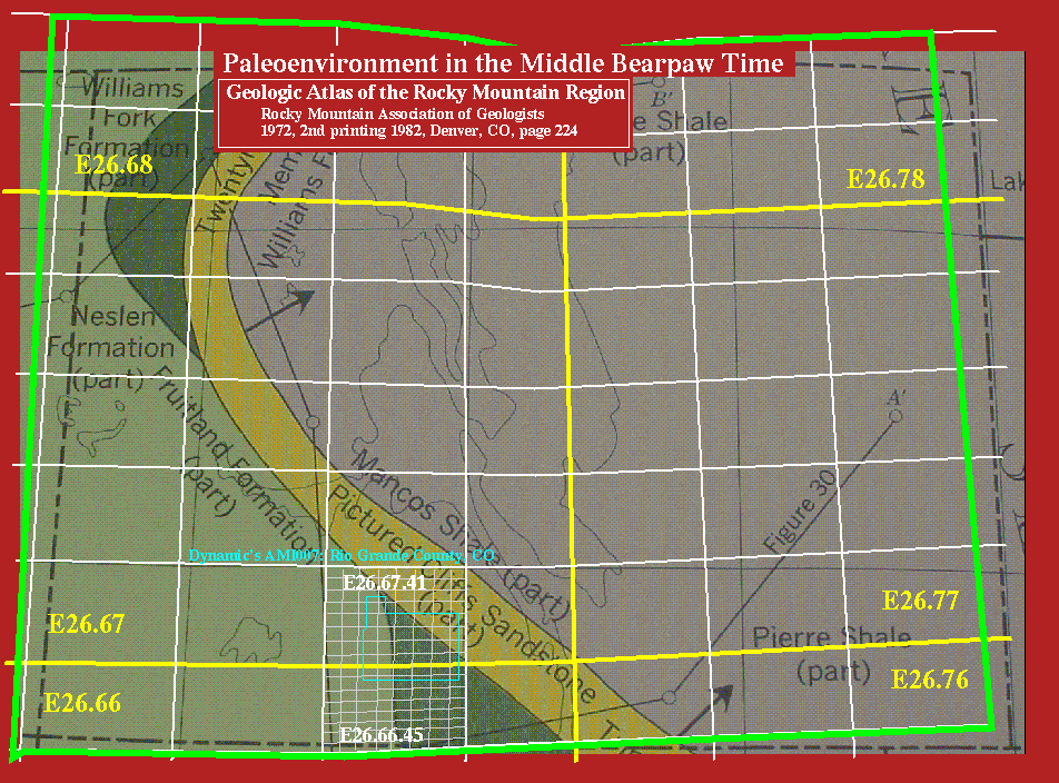
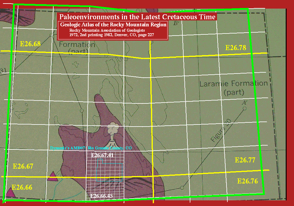
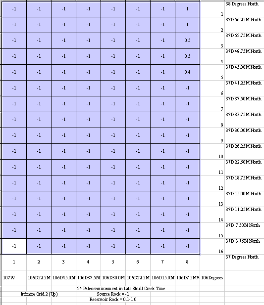
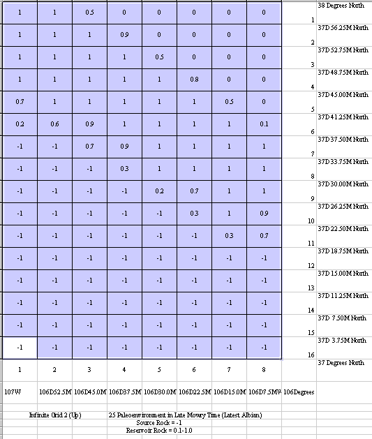
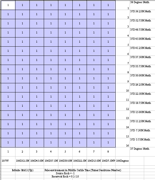
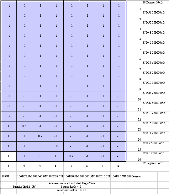
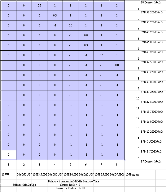
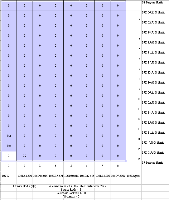
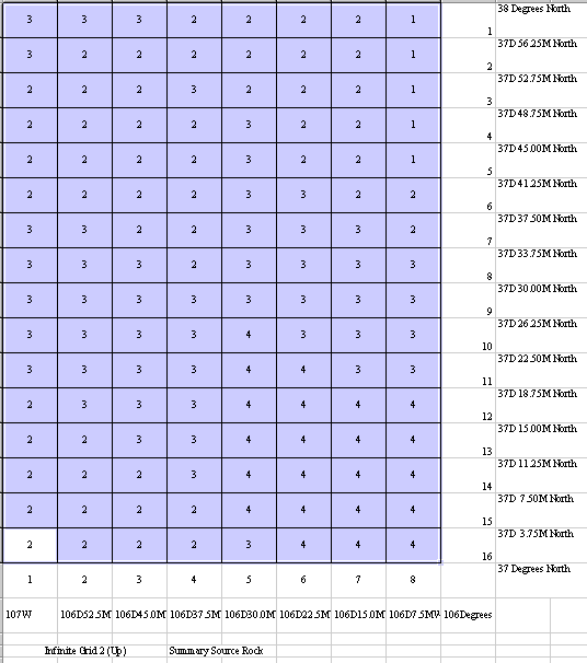
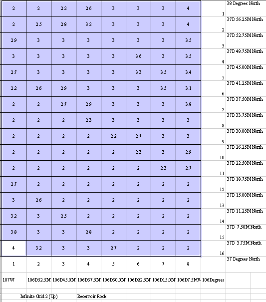
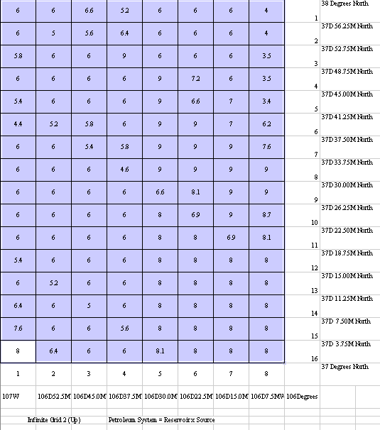
A more extensive example is available for Rio Grande County, Colorado including: a location map out of a book; a digital photograph of a map of the county overlaid with IG4; a lease position map with IG5 overlaid; Northstar's Lease position on an Excel spread-sheet at IG5; and the equivalent display of Aspect's lease position. In addition, there are paleoenvironment maps of the Skull Creek; Mowry; Belle Fourche; Carlile; Eagle; Bearpaw; and Cretaceous. Equivalent Excel spread-sheets of these data include the Skull Creek; Mowry; Belle Forche; Carlile; Eagle; Bearpaw; Cretaceous; source rock sum); reservoir rock sum; petroleum system at IG4); petroleum system at IG5); and the lease position times the petroleum system.
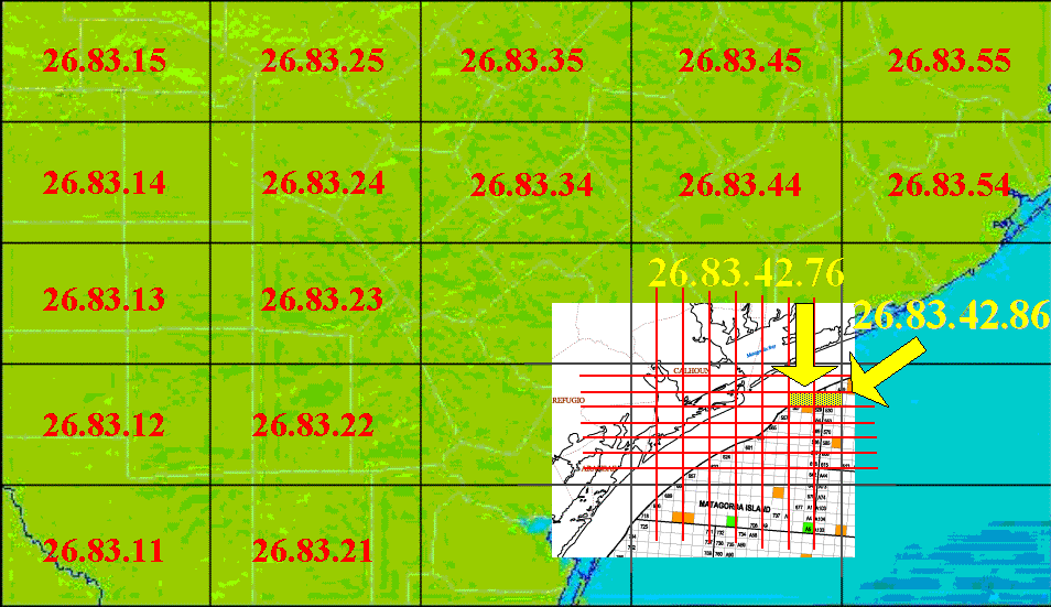
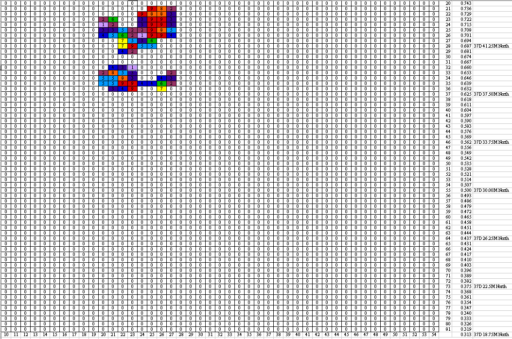
A third example from Wharton County, Texas shows the value of having a database interfaced to the Infinite GridSM. To start with a series of 5 images demonstrate zooming in from the Gulf Coast at IG2 to 26.83 showing IG3 grid cells to 26.83.33-55 with IG3 grid cells to 26.83.33-55 with IG4 grid cells to 26.83.33.73-55.18 with IG4 grid cells. These are further broken down by Colorado, Jackson, Lavaca, and Wharton County at http://www.walden3d.com/dynamic/AMI013. The key images are the three maps, 1. showing Highway 71 and Highway 1693 at Garwood, 2. showing an IG4 overlay, and 3. showing an IG5 overlay. The original map was made by piecing together images from a web mapping tool. In the ideal, each sieve cell will be a linked to raw data of interest which originates within the cell. In this case, we took data which summarized production from each of the wells in the area which exceeded a certain amount of production and entered the values in a spread-sheet as shown at AMI013HiwhawaysKRall.gif. Note that the numbers are too large for the cell size, and so they just show up as ###. A subset of this map is shown at AMI013HighwaysKR.gif, and more detail at the bottom end of this area at AMI013KR.gif. The data entered into these spread-sheets represents about a tenth of the data available to be displayed, and since it was all done manually, we only entered the largest producing fields.
Ideally the Infinite GridSM will be tied to a mapping system, which will allow contouring of values, for better trend analysis. However, if the grid is small enough, relative to the data stored in the grid, then patterns automatically appear from the display, as is shown in a series of displays of Standard Industrial Code 15 at http://www.walden3d.com/SIC. In this case, each cell accumulated a total of the number of businesses with SIC code 18, and the colors are tied to a range from 0 per cell (white) to over 1,400 per 7.5' cell (red). Since SIC 15 relates to Building Construction, it is obvious where the urban areas are within the continental US. Not only that, if you are selling plywood or a similar supply, you know where to locate your store within about 3.7 km of customers.
As another example of the flexibility of the Infinite GridSM approach, note the image showing flow down Coal Creek, Iron County, Utah during the 20th century, with personal experiences highlighted from the data at CoalCreek.jpeg. In this example the vertical axis is day of the year and the horizontal axis is year. The data was downloaded into a spread-sheet, and the spread-sheet values were plotted as a color proporational to their value.
![]()
This page is at: http://www.walden3d.com/dynamic/ig