. . . - . . .  . . .
. . .
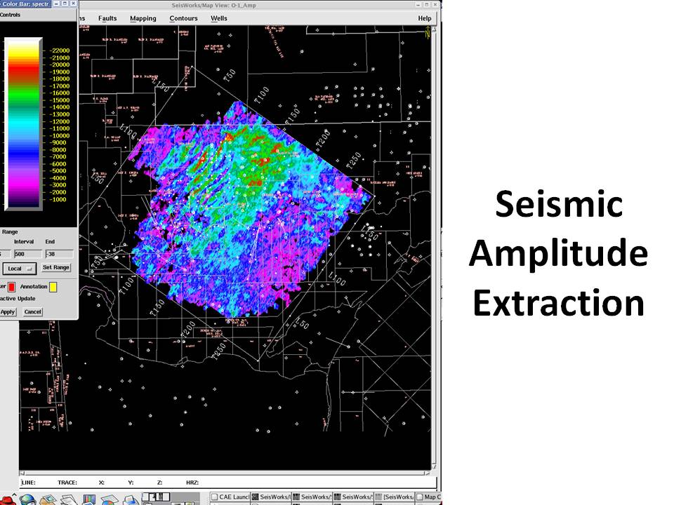
ZAP simultaneously extracts seismic attributes from horizons picked. This is a map of seismic amplitudes extracted from each seismic trace at the travel-time depth of the horizon at that trace. Several different seismic attributes can be extracted at the same time. These seismic attribute maps relate directly to lithologies and fluid content. In this environment in South Texas, the amplitudes colored green and red are related to gas accumulations. This type of mapping is one of the key reasons the percentage of dry holes has dropped so dramatically since the introduction of 3-D seismic and interactive 3-D seismic interpretation.
|