. . . - . . .  . . .
. . .
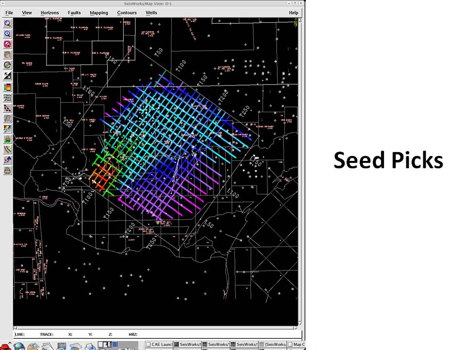
Originally 2-D seismic interpretation, like I did on Yellowstone Lake, is done by coloring horizons on paper seismic sections with colored pencils. The travel-time for picks were then manually posted at regular trace intervals on a map and hand contoured. At Landmark we pioneered having the computer post the picks on the cross-sections and the maps. This map shows seed picks made on the grid of seismic sections, like the section shown earlier, and on the map. These horizon picks can be done manually, like using a colored pencil on a paper section, or there are automated tools for following the same seismic wavelet trace to trace. It is orders of magnitude faster to do this interpretation with a workstation than manually. (ZAP Horizon Interpretation and Extracted Seismic Attribute)
|