. . . - . . .  . . .
. . .
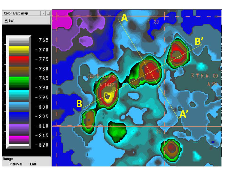
There are several competing workstation solutions available these days. There are enough similarities the solutions are basically a commodity. They each make maps of the subsurface from well and seismic data, like is shown below. This map is from Shackelford County, Texas and shows the top of the Mississippian Limestone. The three red blobs are Mississippian pinnacle reefs. The center reef has not been drilled. It is 27.8 acres and the volume is calculated at 3,892 acre feet. At 200 barrels of oil per acre foot (15-20% porosity) this is worth $77.8 million at $100/barrell. At 5.8 million cubic feet of gas per barrel of oil and $5/mcf (thousand cubic feet of gas), this size trap is worth $22.6 million or a factor of 3.4 less than an equivalent sized oil field. 3-D seismic and workstation technologies have decreased risk from 2 successful wells per 10 drilled to 7 or 8 successful wells per 10 drilled. The A-A' and B-B' lines show the location of seismic cross-sections pulled out of the 3-D seismic volume and displed on the next slide. (Shackelford cross-sections and attribute map)
|