
![]()
Often simple ideas are the hardest to grasp. In our complicted world, we tend to expect things to be very complicated. Simple ideas are also hard to present. Mostly because they can involve a different way of thinking, and it is hard to change our way of thinking.
This page is the result of manually building a relationship (or a mapping, or a cross-reference) between a table listing Census Tracts in Harris County and a map of Harris County. The relationships are bidirectional, in that data can be entered into a Census Tract table and will automatically plot on a Harris County map, or data can be entered onto a Harris County map and will automatically be be summed for each Census Tract in a Census Tract table. Although it was fairly manually intensive to build this spread-sheet, the process can be automated. Spread-sheets are an ideal medium for data input and data review by the masses. An equivalent raster-based GIS (Geographical Information System) product is envisioned, which could become the spatial and temporal equivalent to the spread-sheet. As these ideas mature, it is expected the master data storage will be driven by standard SQL databases like Access and Oracle. Eventually everyone will be able to download data directly to an WristinfoSM, which provides location with a GPS chip (Global Positioning System). This concept is explored at http://www.walden3d.com/wristinfo.
On this page are links to screen captures which illustrate moving up and down Infinite GridSM scales. The spread-sheet created to do this work in Harris County is available for download and evaluation. It is not available for reverse engineering by those who desire to build a competitive product, and your assistance in protecting Walden 3-D, Inc.'s intellectual property is greatly appreciated. We request you to download a confidentiality agreement (http://www.walden3d.com/H/sample/IG_Confidential_Agreement.doc), sign it, and facsimile a copy back to Walden 3-D, Inc. or Dynamic Resources Corporation, the oil exploration subsidiary, at 281.579.2141.
For reference, there has been considerable think time put into the Infinite GridSM. The idea was introduced to Walden 3-D, Inc. by Bill Bavinger, who died several years ago in a freak car accident. An early prototype was created using data from Select Phone, and can be reviewed at http://www.walden3d.com/SIC. Select Phone is a quarterly CD publication of telephone numbers in the United States. They not only publish every phone number that is not unlisted, but they include 4 levels of SIC for business (Standard Industrial Codes used for taxing and yellow pages), and the longitude and latitude of the phone jacks (+/-5 meters). Bavinger did a sort of SIC code 15 (Building Construction - General Contractors and Operative Builders) against what we now call an IG4 (Infinite GridSM Level 4 or 7.5o Longitude and 3.75o Latitude). The above reference shows 6 views of the resulting data displayed on a Landmark Graphics workstation and 2 views displayed using Spyglass on a PC. The number of businesses with SIC code 15 for each IG4 cell were counted and mapped. The results are fascinating because it shows, within about 7 km, where to open a plywood store everyplace in the United States. The data becomes a much more accurate map of the world, with more context, than most of the maps we regularly use.
The intent is that the Excel spread-sheet hcct_input.xls will be a backup original, and copies will be made, with worksheets added and deleted, copied and modified, to meet specific data visualization within Harris County, Texas. As such there are three examples of worksheets taking input from one worksheet and translating that data to a different format on another worksheet, and there are three worksheets which are included to allow them to become either input or output for specific data visulazation projects.
Census Tract Table Input translated to IG5 Output and to IG4 Output:
Note: Click on tumbnails for expanded image view.
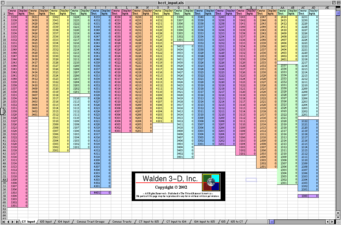 | ----> | 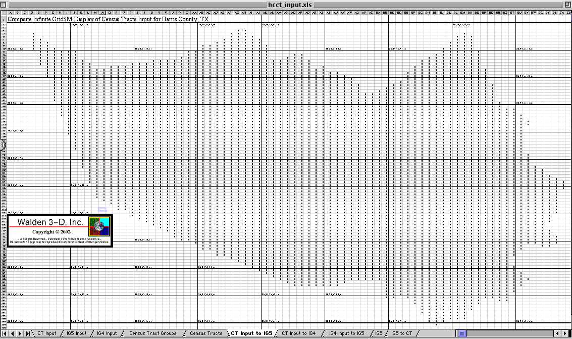 |
| Worksheet 1: Census Tract Input | Worksheet 6: IG5 Output | |
| | | | | V | ||
 | ||
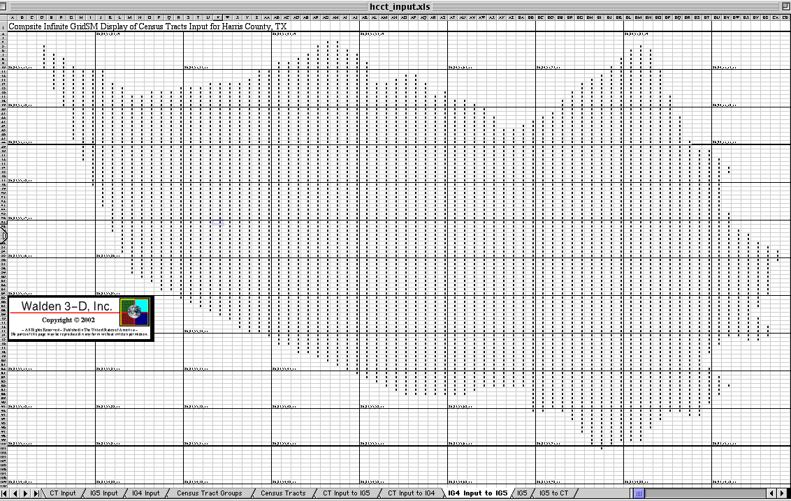
| Worksheet 7: IG4 Output |
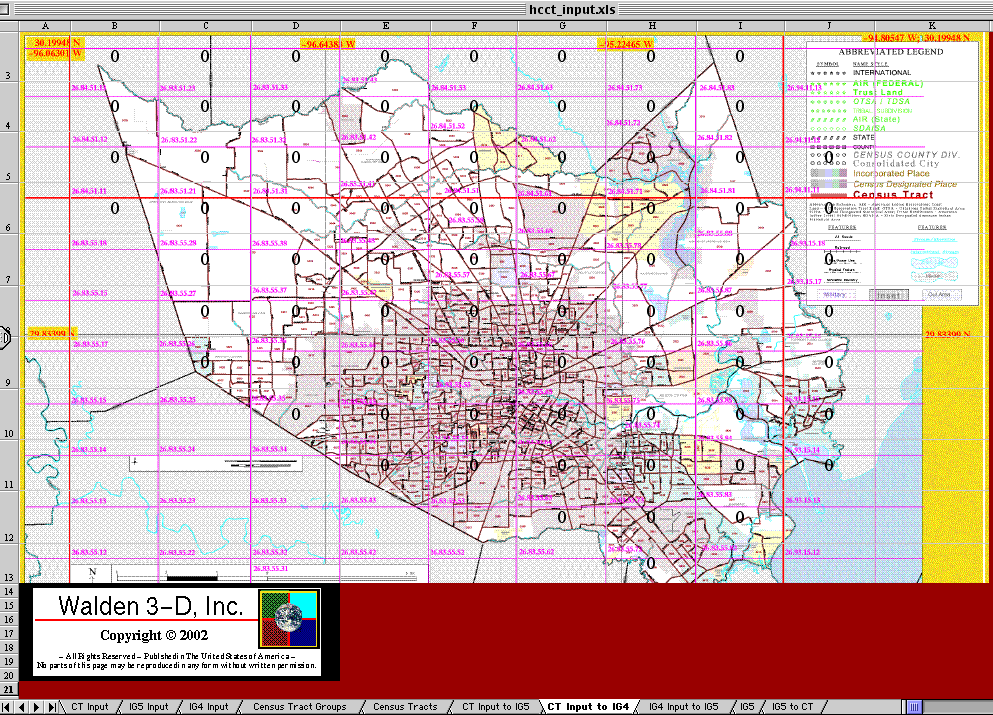
IG4 Input translated to IG5 Output:
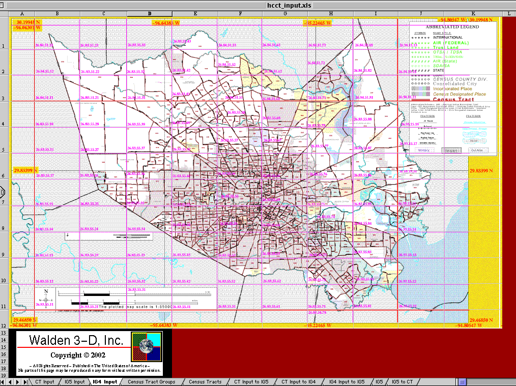 | ----> |  |
| Worksheet 3: IG4 Input | Worksheet 8: IG5 Output |
IG5 Input translated to Census Tract Table Output:
 | ----> | 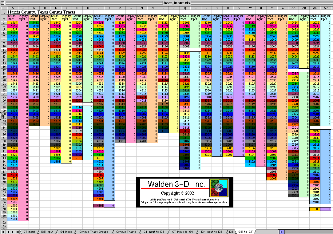 |
| Worksheet 9: IG5 Input | Worksheet 9a: Census Tract Table Output |
Three Worksheets which can become either Input or Output:
 | 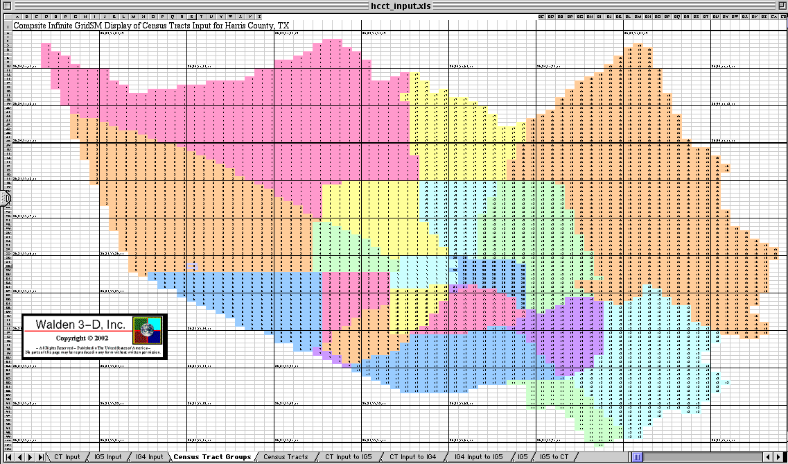 | 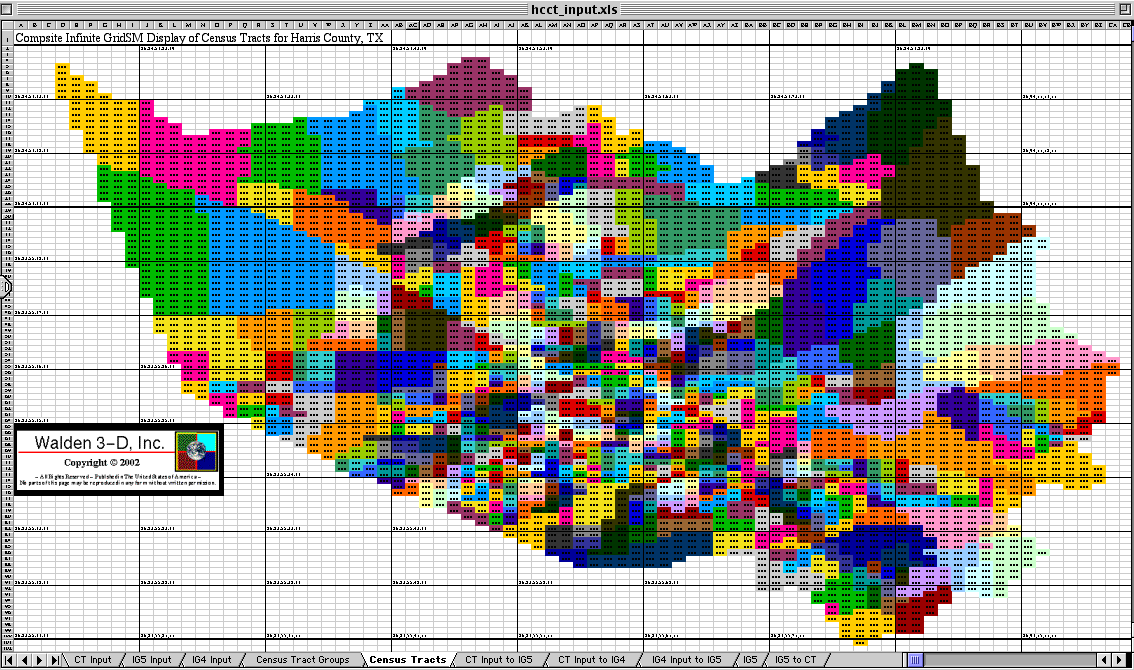 |
| Worksheet 2: IG5 small scale | Worksheet 4: Census Tract Groups | Worksheet 5: Census Tracts |
The next logical step is to get the funding to automate this process and to develop an Infinite GridSM database for Texass and the rest of the country. A sample of the variety of ways this can be used to benefit individuals and families and scientists and politicians and the country and the world are presented at http://www.walden3d.com/H/sample/Ozone/index.html
![]()
This page is at: http://www.walden3d.com/H/sample/CTmapCT/index.html