![]()
![]()
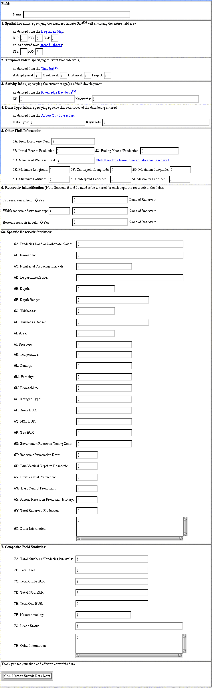
Click here for composite screen capture of Field Data Input Form
1. Spatial Location, specifying the smallest Infinite GridSM cell enclosing the entire field area
IG2: IG3: IG4: or, as derived from spread-sheets: IG5: IG6: | |||||||||||||||||||||||||||||||||||||||||||||||||||||||||||||||||||||||||||||
2. Temporal Index, specifying relevant time intervals,
Astrophysical: Geological: Historical: Project: | |||||||||||||||||||||||||||||||||||||||||||||||||||||||||||||||||||||||||||||
3. Activity Index, specifying the current stage(s) of field development
KB: Keywords: | |||||||||||||||||||||||||||||||||||||||||||||||||||||||||||||||||||||||||||||
4. Data Type Index, specifying specific characteristics of the data being entered:
Data Type: Keywords: | |||||||||||||||||||||||||||||||||||||||||||||||||||||||||||||||||||||||||||||
5. Other Field Information:
5B. Initial Year of Production: 5C. Ending Year of Production: 5D. Number of Wells in Field: Click Here for a Form to enter data about each well. 5E. Minimum Longitude: 5F. Centerpoint Longitude: 5G. Maximum Longitude: 5H. Minimum Latitude:_ 5I. Centerpoint Latitude:__ 5J. Maximum Latitude:__ | |||||||||||||||||||||||||||||||||||||||||||||||||||||||||||||||||||||||||||||
6. Reservoir Indentification (Note Sections 6 and 6a need to be entered for each separate reservoir in the field):
6a. Specific Reservoir Statistics: |
7. Composite Field Statistics: |
Thank you for your time and effort to enter this data. |
![]()
This page is at: http://www.walden3d.com/dynamic/iraq/fields/Data_Input.html