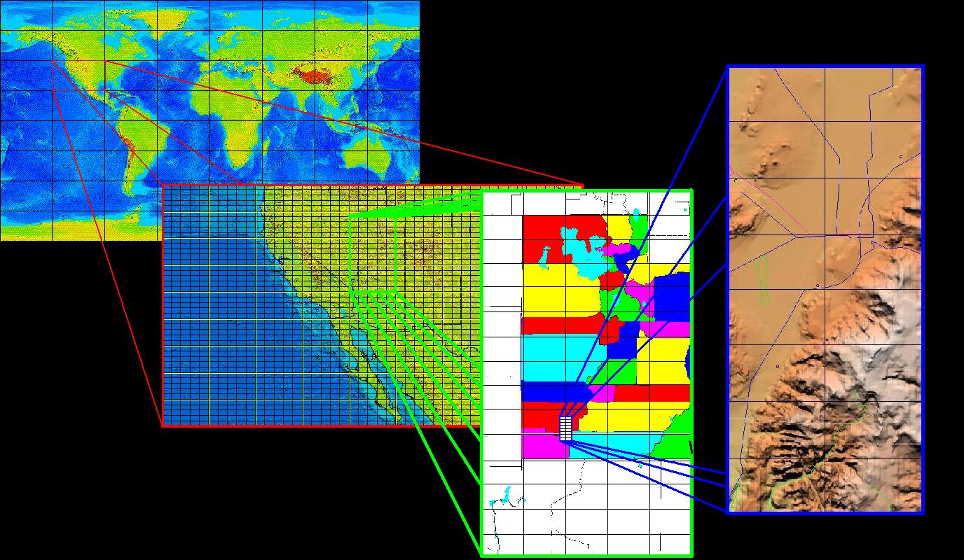
Spotfire has add-ons which can accomodate ESRI vector basemaps. Alternatively, a raster image can be made and placed in the background. This series of images shows a process known as The Infinite Grid
SM
, to generate a map at the appropriate scale for bacground context. These maps were generated from Cornell's Digital Earth initiative.
Copyright © 2005 Walden 3-D, Inc.